Books and Maps
This section is designed to include a summary of recently published books and mapping useful for all walkers in the British Isles. Links are provided so you can obtain further detailed information and complete on-line purchases.
Cicerone Press 
An excellent range of guides and maps produced by a publisher dedicated to outdoor activities including walking, scrambling and cycling. The following are a selection from their exhaustive catalogue.
The Cleveland Way Map Booklet
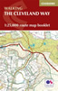 Map booklet of the Cleveland Way National Trail, a 177km (110 mile) walk around the North York Moors National Park. This booklet is included with the Cicerone guidebook to the Cleveland Way and the Yorkshire Wolds Way, and shows the full route of the Cleveland Way on Ordnance Survey 1:25,000 maps.
More information
Lake District: Low Level and Lake Walks
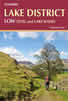 This guidebook describes 30 of the best low-level walks in the Lake District. From delightful wooded glades and sparkling tarns, to waterfalls and glacier-carved valleys towered over by craggy mountains. The walks described aim to seek out the best walking that the lower areas of the Lake District have to offer.
More information
Pennine Way Map Booklet
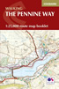 Map of the 270 miles (435km) Pennine Way National Trail, between Edale in the Peak District and Kirk Yetholm in the Scottish Borders. This booklet is included with the Cicerone guidebook to the trail, and shows the full route on Ordnance Survey 1:25,000 maps. This popular long-distance route typically takes three weeks to complete.
More information
Walking in Northumberland
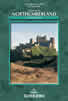 This guidebook contains detailed route descriptions for 36 day walks in Northumberland including the Cheviot Hills. The terrain varies from wild walks and craggy ascents to gentle riverside strolls. Each route ranges from 4 to 16 miles in length and there is the opportunity to link several walks together to create longer treks.
More information
The Cumbria Way
 A guidebook to the 73 mile Cumbria Way, an easy long-distance walk though the heart of the Lake District National Park, from Ulverston in the south to Carlisle in the north, with good transport links to either end. The route is largely low-level but this guide offers alternative mountain days to climb some of the famous fells en route.
More information
Walking Loch Lomond and the Trossachs
 A guide to walking and scrambling routes in the beautiful Loch Lomond and the Trossachs National Park. Over 70 graded low-level, mid-level and mountain walks taking in hills, glens and picturesque woodland, as well as all of the region's Munro summits. Highlights include Ben Lui, Ben Lomond, the Cobbler and the Arrochar Alps.
More information
The Wales Coast Path
 A single guidebook to walking the whole Wales Coast Path - 1400km (870 miles) the length of Wales from Chester to Chepstow, including Anglesey, described in 57 stages. The route passes through the Snowdonia and Pembrokeshire National Parks and many AONBs and can be linked with the Offa's Dyke Path for a complete circuit of Wales.
More information
Anquet Digital Mapping 
The excellent digital mapping supplied by Anquet is available in a range of formats. Probably the most popular with walkers are their digital format and detailed OS Explorer maps at 1:25k scale. OS Landranger 1:50k maps are also available although showing less detail. Harveys produce Superwalker maps at 1:25k and British Mountain Maps at 1:40k both offering a different style of mapping to the more familiar OS maps. Harvey maps often include additional detail, including more paths, not shown on OS mapping.
For regular walkers there are a number of packages available which offer considerable savings:
| OS Explorer 1:25k Mapping of Complete Great Britain | More Information |
| OS Explorer 1:25k Mapping of British National Parks | More Information |
News & Reviews
A range of product reviews including books and maps are available. The following reviews are the most recent.
Wainwright Hill Bagging Map - A scratchable map showing all 214 Wainwrights in the Lake District. More info.
the people's poncho 2.0 - Lightweight, stylish and lightweight alternative to traditional waterproofs ideal for walkers. More info.
the people's poncho - A durable, lightweight, stylish and compact alternative to traditional waterproofs ideal for walkers with 10% Discount. More info.
AZ Adventure Series Maps - Convenient 1:25000 OS maps in booklet form covering the National Trails of Britain. More info.
Walking in the Aire - A new book by Lee Senior featuring 14 walks in the Aire valley. More info.
West Yorkshire's Wild Side - Two new books in the 'Wainwright' style featuring Calderdale and moorland walks. More info.
Follow Walking Britain for the latest news. 
![]()