Cavenham Heath and Lark Valley from Mildenhall
Suffolk Walk
County/Area - Suffolk
Author - Lou Johnson
Length - 7.8 miles / 12.7 km Ascent - 300 feet / 91 metres
Time - 4 hours 10 minutes Grade - easy/mod
Maps 

| Ordnance Survey Explorer 226 | Sheet Map | 1:25k | BUY |
| Anquet OS Explorer 226 | Digital Map | 1:25k | BUY |
Walk Route Description
Click image to see photo description.
This Suffolk walk is ideal for all times of the year. Cavenham Heath National Nature Reserve is particularly pretty when the heather is in flower during the summer. The walk starts from the Jubilee Fields car park adjacent to the Jubilee Centre in Mildenhall (grid ref. TL712744).
After parking exit the car park take the path to reach the banks of the River Lark. Turn left along the river and cross the bridge. Once across the river continue in the same direction across the Hanbury-Kelk nature reserve. This leads to Mildenhall Road in Barton Mills (grid ref. TL713739). Turn left through the village passing the church on your left to reach Bell Lane on your right (with the Bell Inn pub). Stay on Bell Lane to a T-junction (grid ref. TL719735).
Cross the road and take the track opposite which soon becomes a grassy path. Reaching the busy (and fast) A11, cross with care and continue along the path on the other side. The path improves to become a track that leads to a cross roads (grid ref. TL722721). Turn left along Worlington Road and continue towards Tuddenham village. There is a grass verge along most of this section of road walking. Bear right at the first road junction and straight ahead at the second junction to reach the centre of Tuddenham.
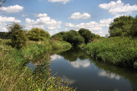
Reaching the village green, turn left down The Green (just before the telephone box). This tarmac lane, part of the Icknield Way Trail, becomes a track and continues across Cavenham Heath to the banks of the River Lark. Cross the river by the bridge and turn left to follow the riverside path. After a delightful section along the Lark Valley, the path leaves the river bank and exits onto the A11. Turn left along the verge, and then use the marked crossing over the central reservation to the other side of the dual carriageway. Once across the A11, go straight down the path and turn right into Old Mill Lane. Turn left down to the river bank and continue back to the start.
Note This circular walk does contain some unavoidable road walking, which for the most part, has grassy verges for your safety. The route also crosses the busy A11 at two points where extra care is needed.
Other walks nearby
| Walk 2476 | Moulton & Gazeley Circular | easy | 6.7 miles |
| Walk 1938 | The Devil's Dyke from Reach | easy | 5.8 miles |
| Walk 3569 | Swaffham Prior & Devil's Dyke from Reach | easy/mod | 6.6 miles |
| Walk 2352 | Lode Mill, Quy Water & Quy Fen | easy | 4.2 miles |
| Walk 3263 | Clare and Cavendish Circular | easy/mod | 7.7 miles |
| Walk 3245 | Woolpit and Rattelesden circular | easy/mod | 6.0 miles |
| Walk 3721 | Oakington and Longstanton round via Rampton Drift | easy | 6.0 miles |
| Walk 2127 | The Brecks from near Thompson | easy | 6.8 miles |
| Walk 1448 | Lavenham circular from Long Melford | easy/mod | 9.8 miles |
| Walk 3618 | Brent Eleigh from Lavenham | easy | 5.0 miles |
Recommended Books & eBooks
Suffolk Coast and Heath Walks
 Guidebook to three long-distance routes exploring the varied landscapes of the Suffolk Coast and Heaths AONB. The Suffolk Coast Path covers 55 to 60 miles from Lowestoft to Felixstowe. The Stour and Orwell Walk is 40 miles from Felixstowe to Cattawade near Manningtree, while the Sandlings Walk is 59 miles from Ipswich to Southwold.
More information
Messaging & Social Media
Message Walking Britain and follow the latest news.

Mountain Weather
Stay safe on the mountains with detailed weather forecasts - for iOS devices or for Android devices.