Woolpit and Rattelesden circular
Suffolk Walk
County/Area - Suffolk
Author - Lou Johnson
Length - 6.0 miles / 9.8 km Ascent - 250 feet / 76 metres
Time - 3 hours 20 minutes Grade - easy/mod
Maps 

| Ordnance Survey Explorer 211 | Sheet Map | 1:25k | BUY |
| Anquet OS Explorer 211 | Digital Map | 1:25k | BUY |
Walk Route Description
Click image to see photo description.
This pleasant Suffolk walk starts from the village of Rattlesden and explores the countryside to the north. The route passes Clopton Hall and continues north to the beautiful village of Woolpit where refreshments are available. The walk continues back to the start using lanes and public rights of way. An ideal staring point in Rattlesden is the lay-by on Lower Road opposite the Brewers Arms pub (grid ref. TL978589).
After parking walk east along Lower Road (facing the pub - go right). Where the main road turns to the left, so straight ahead into Birds Green. After passing a number of thatched cottages on your left, bear left soon passing the playing fields, which are also on your left. Take the concrete track (with a footpath fingerpost) which soon leads to a footpath across fields to reach Stowmarket Road (grid ref. TL985593). Turn left across the bridge and almost immediately right onto a clear track (Back Road on OS maps). Ignore the footpath on the left after 200 metres and continue to where Back Road turns sharp right (grid ref. TL987595) where you turn left towards Clopton Hall. Continue past Clopton Hall on your left and follow the access track passing Clopton Green Farm on your left to reach a road (grid ref. TL978602).
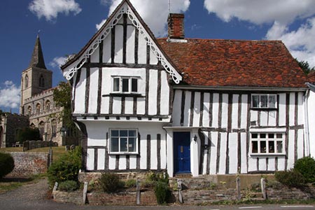
Turn right along this road for about just over a kilometre to a road junction in Woolpit Green (grid ref. TL976615). Turn left and almost immediately take the footpath on your right. This leads north to join Steels Road. Turn left and take the first road on the right (Abbotts Meadow). After 70 metres turn left onto the tarmac path (with adjacent no cycling sign) and continue ahead to Green Road. Turn right walk into the centre of Woolpit. Turn right in front of the Post Office to reach the fine Parish Church of St Mary's.
After visiting the church, return past the Post Office and turn right and then left down Rags Lane. Continue to the end of the lane. Turn left into Broomhill Lane. Just before the next junction, turn right onto a signed path (grid ref. TL969622) across fields. Continue straight across a lane (grid ref. TL967620). Reaching a path flanked by trees, turn left (Deadman's Lane on OS maps). After 70 metres turn right onto a path along the edge of a field. The path then heads half left and over a small bridge. Away to your right you have a view to Drinkstone Windmill.
Keep the hedge on your left and at the next waymark turn left (grid ref. TL962616). The path follows the hedge as it goes right and then left to exit onto a narrow lane (grid ref. TL963612). Turn left along the lane to a T-junction. Turn right here and walk past Burts Farm following the lane around to the left. After a few metres, just as the lane straightens, take the grassy track on your right (grid ref TL967608) soon passing a small pond on your right. Turn left just after a small wooden footbridge and then right heading almost due south.
After a 1.5 kilometres you pass under overhead power lines (grid ref TL974595). Keep ahead here and soon after the path curves to the right. Turn left here and follow the path a cross field towards Rattlesden. Reaching the far side of the field bear left (do not join School Lane) and then right along the edge of a field. The path passes through a few gates to reach High Street. Cross the churchyard of St Nicholas and exit by half-timbered Old Moot House. Turn right along Lower Road and the start of the walk is a short distance down this road.
Other walks nearby
| Walk 3411 | Buxhall to Drinkstone Green | easy/mod | 7.5 miles |
| Walk 3618 | Brent Eleigh from Lavenham | easy | 5.0 miles |
| Walk 1448 | Lavenham circular from Long Melford | easy/mod | 9.8 miles |
| Walk 1445 | Historic Long Melford | easy/mod | 8.0 miles |
| Walk 1446 | Sudbury circular from Long Melford | easy | 5.5 miles |
| Walk 3724 | River Box from Stoke-by-Nayland | easy | 6.0 miles |
| Walk 3660 | Stour Valley & Dedham from Flatford Mill | easy | 3.5 miles |
| Walk 3263 | Clare and Cavendish Circular | easy/mod | 7.7 miles |
| Walk 2374 | Freston Circular | easy/mod | 6.6 miles |
| Walk 2096 | Alton Water, Stutton & Tattingstone | easy | 5.5 miles |
Recommended Books & eBooks
Suffolk Coast and Heath Walks
 Guidebook to three long-distance routes exploring the varied landscapes of the Suffolk Coast and Heaths AONB. The Suffolk Coast Path covers 55 to 60 miles from Lowestoft to Felixstowe. The Stour and Orwell Walk is 40 miles from Felixstowe to Cattawade near Manningtree, while the Sandlings Walk is 59 miles from Ipswich to Southwold.
More information
Messaging & Social Media
Message Walking Britain and follow the latest news.

Mountain Weather
Stay safe on the mountains with detailed weather forecasts - for iOS devices or for Android devices.