Waterproof Maps - a Comparison
Most of us take a map when we go walking and we tend to assume they are clear and accurate. This review compares two maps covering the same area, both having the added advantage that they are waterproof.
Harvey Maps - Dark Peak including the Gritstone Edges
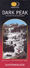 Less popular than the comparative Ordnance Survey series these maps offer quality 1:25000 mapping aimed specifically at walkers. At first glance the maps are colourful and easy to read. Look closer and you will discover a host of information that will help your navigation and awareness of the terrain. The following summary identifies the key features:
- Waterproof paper with map packed in a plastic sleeve
- 1:25000 scale
- Clear uncluttered style with enough detail for navigation
- More paths shown than on the OS equivalent
- Includes paths that are visible on the ground but are not right of ways
- Clear use of colour to show land use
- Very easy to read contouring
- Clear and easy to read typeface
LAM-FOLD - Ordnance Survey - Explorer OL1 - Dark Peak Area
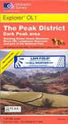 Based on the recently 'repackaged' Explorer (formerly Outdoor Leisure) Maps with an orange cover. They provide walkers with a valuable tool when out in the countryside.
Less widely available than their paper 'cousins', their key features are :
- Conventional paper map in a sealed laminated protective film
- Tear resistant
- Write on wipe off surface
- 1:25000 scale
- Standard Ordnance Survey details
- Easy to read style that we are all familiar with
- Some shortcomings with accuracy of paths
- Fully contoured with high level of detail
Comparison
Personal preference has a lot to do with which maps you use. A dedicated user of Ordnance Survey mapping for many years, I was surprised to discover how easy Harvey Maps are to use. At first glance they seem to be lacking in data but on closer inspection you soon discover they contain information that is relevant to walkers discarding much data that is not of use. They also benefit from detailing paths as being visible on the ground or not visible with the inclusion of many more paths especially in open country. In contrast the LAM-FOLD map is of very sturdy construction and will probably last longer if badly handled.
Verdict
Harvey Maps 

- easy to read
- aimed specifically at walkers
- shorter life?
Lam-Fold / OS 
- very robust
- too much detail?
- bulky
Review date - 14th July 2002 - Reviewed by LJ
News & Reviews
A range of product reviews including books and maps are available. The following reviews are the most recent.
Wainwright Hill Bagging Map - A scratchable map showing all 214 Wainwrights in the Lake District. More info.
the people's poncho 2.0 - Lightweight, stylish and lightweight alternative to traditional waterproofs ideal for walkers. More info.
the people's poncho - A durable, lightweight, stylish and compact alternative to traditional waterproofs ideal for walkers with 10% Discount. More info.
AZ Adventure Series Maps - Convenient 1:25000 OS maps in booklet form covering the National Trails of Britain. More info.
Walking in the Aire - A new book by Lee Senior featuring 14 walks in the Aire valley. More info.
West Yorkshire's Wild Side - Two new books in the 'Wainwright' style featuring Calderdale and moorland walks. More info.
Follow Walking Britain for the latest news. 
![]()