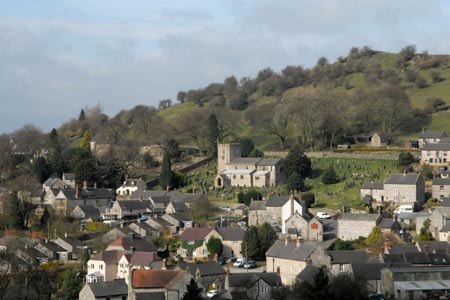
Carsington and Harboro Rocks from Brassington
Derbyshire Walk
County/Area - Derbyshire - South East Derbyshire
Author - Lou Johnson
Length - 5.8 miles / 9.3 km Ascent - 900 feet / 273 metres
Time - 3 hours 50 minutes Grade - easy/mod
Maps 

| Ordnance Survey Explorer OL24 | Sheet Map | 1:25k | BUY |
| Anquet OS Explorer OL24 | Digital Map | 1:25k | BUY |
| Ordnance Survey Landranger 119 | Sheet Map | 1:50k | BUY |
| Anquet OS Landranger 119 | Digital Map | 1:50k | BUY |
Walk Route Description
Click image to visit gallery of 11 images.
Brassington village is located outside the boundaries of the Peak District National Park. However it still bears all the hallmarks of the White Peak with dry stone walls and stone built cottages set amidst rolling countryside. This walk explores the area to the east and north of the village and using paths and quiet country lanes includes Carsington village, the High Peak Trail, Harboro Rocks and a short section of the Limestone Way.
There is usually space to park on street in Brassington village (grid ref. SK230543) by the church. Please be considerate when parking and ensure that you are not causing inconvenience for residents. With your back to the church, walk down the street with the Miner's Arms pub on your right. Reaching the main road through the village, Town Street, cross the road. Take the signed footpath opposite. This leads into fields and climbs on a clear path to reach a wall (grid ref. SK234542). Turn right here and follow the clear path or track as it contours around the hillside offering a grandstand view of Brassington. This path leads to a crossing farm track (grid ref. SK238539). Here continue ahead climbing slightly. The onward path is clear and begins to descend into Carsington village. To your right there are views over Carsington Reservoir.
Joining a tarmac lane in Carsington continue straight ahead to a road junction (grid ref. SK251534). Go left here along a narrow lane lined with cottages. There is a footpath sign. This path leads onto the open hillside. At first the path climbs steeply with views to the right over the village. Initially the path trends towards a wall at the opposite side of the field before bearing left to complete the ascent beside this wall. Nearing the top you will pass a limestone outcrop on the other side of the wall called the King's Chair.
Away to your left is a recently constructed wind farm which has somewhat spoiled the immediate surroundings of Carsington Pasture. The path continues more easily to a lane. Turn right for a few yards and then cross the road and join the High Peak Trail. Our route is going west (left) along the Trail but it is worth walking a short way east (right) to see one of the former inclines on the Cromford and High Peak Railway.
Heading west along the High Peak Trail you will notice that there is evidence of former and current industry, perhaps the reason for this area's exclusion from the National Park. After about one kilometre you reach a factory on the left hand side of the trail. Just before the factory there is a signed footpath on the right (grid ref. SK242550). Turn right here and follow the clear path to the summit of Harboro Rocks which are a popular venue for climbers. The Rocks are a suitable place to take a break and enjoy the view.
Return down to the High Peak Trail and continue west. After about a kilometre the Limestone Way crosses the Trail (grid ref. SK236556). Turn left here and follow the clear path through walled meadows to a road (grid ref. SK233549). Turn right along the road to a T-junction. Turn right and walk about 250 metres to locate a footpath on the left (grid ref. SK229551). Turn left down this continuation of the Limestone Way undulating walled fields to reach a walled lane and a signed path on your left (grid ref. SK225545). Turn left down this path losing height quickly as you descend into Brassington and a small lane. Turn left along this lane and turn right through the churchyard to regain the start.
Other walks nearby
| Walk 2701 | Harboro Rocks & Brassington | easy/mod | 6.5 miles |
| Walk 3672 | Carsington Water, Hognaston & Madge Hill | easy/mod | 5.5 miles |
| Walk 2993 | Carsington, Brassington & Cromford and High Peak Railway from Middleton | moderate | 9.5 miles |
| Walk 1892 | Minninglow & Roystone Rocks | easy/mod | 5.8 miles |
| Walk 1410 | Minninglow Hill, Roystone Grange and Cardlemere Lane from Gotham | easy/mod | 5.5 miles |
| Walk 2559 | Stanton Moor & The Nine Ladies Stones from Winster | moderate | 9.0 miles |
| Walk 3196 | Stanton Moor and Robin Hood's Stride from Winster | easy/mod | 7.0 miles |
| Walk 2136 | Wensley & Brightgate | easy/mod | 6.2 miles |
| Walk 2503 | Robin Hood's Stride & Stanton Moor | moderate | 11.0 miles |
| Walk 2627 | Cromford to Bakewell | moderate | 11.5 miles |
Recommended Books & eBooks
Walking in the Peak District - White Peak East
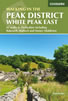 Guidebook describing 42 half-day and day walks in the limestone landscapes of Derbyshire's White Peak, part of the Peak District National Park. One of two volumes, this book covers the east of the region, with potential bases including Bakewell, Eyam, Castleton, Birchover, Matlock and Wirksworth.
More information
Walking in Derbyshire
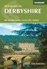 Walking guidebook to 60 circular day walks in Derbyshire and the Peak District. Includes the Derwent, Wye and Trent river valleys, near Derby, Matlock, Glossop, Bakewell and Ripley. Routes range from easy to moderate and are between 4 and 14km (2 to 10 miles). Walks focus on places of interest, from Stone Age forts to castles to grand estates.
More information
Messaging & Social Media
Message Walking Britain and follow the latest news.

Mountain Weather
Stay safe on the mountains with detailed weather forecasts - for iOS devices or for Android devices.