Bleaklow & The Longendale Trail from Woodhead
Peak District Walk
Nat Park - Peak District - Bleaklow Longendale
County/Area - Derbyshire
Author - Andy Chaplin
Length - 10.0 miles / 16.3 km Ascent - 1600 feet / 485 metres
Time - 6 hours 40 minutes Grade - mod/hard
Maps 

| Ordnance Survey Explorer OL1 | Sheet Map | 1:25k | BUY |
| Anquet OS Explorer OL1 | Digital Map | 1:25k | BUY |
| Ordnance Survey Landranger 110 | Sheet Map | 1:50k | BUY |
| Anquet OS Landranger 110 | Digital Map | 1:50k | BUY |
Walk Route Description
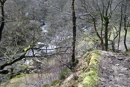
Click image to visit gallery of 3 images.
I have walked this twice and, on both occasions, have never managed to get to Bleaklow Head which is where I have always planned to meet up with the Pennine Way. That aside, the walk up Near Black Clough and then down Torside Clough is spectacular and the route back along the Longdendale Trail to the Woodhead tunnels is much better than most ex-railway walking. So, the Peak District walk described here is as I have done it - if you want to get to Bleaklow Head - then good luck.
Start at the car park by the Woodhead Tunnels just off the A628 (grid ref. SK114998) and cross the river Etherow and follow the track along its south bank to Near Black Clough. Don't cross the clough at the ford but turn right up the clough side. Some 50m later there is a path off on the right up the hill. If you miss this there is another almost coming back on yourself another 50m further on.
Follow the path along the clough side for another 2.25 miles. It is well defined all the way up and the views behind are worth stopping for as you ascend the 1100 feet to the top. As you get to the top you will see fence posts in front of you at. At SK098965 the path somewhere to your left follows the remains of the clough towards Bleaklow Head. At this point there is also a better-defined path or sheep track heading to the right-hand corner of the wire fence in front of you. If you follow the fence, as this route does, then you will come to the Pennine Way at grid ref. SK091965.
There is some cross country involved but the fence is an easy feature to follow on the top of a rather featureless Bleaklow. The Pennine Way is on the left of the fence that you are following so at some point you will need to step over or through it which can be managed without causing damage. Turn north on the Pennine Way path and enjoy the views as you descend down the west side of Torside Clough. At the bottom pick up the Longdendale Trail and follow it for 4 miles along the southern side of the reservoirs and back to the Woodhead tunnels, old station platforms and car park.
Editor's Note - the Bleaklow landscape can be very confusing especially in mist so this is a walk for walkers competent at using maps. GPS might also be a benefit. I have found Bleaklow Head a number of times using map and compass to navigate across the deep groughs in the peaty wasteland. However it was not an easy task when approaching from Longendale and required plenty of persistence and patience! Finding Bleaklow Head is much easier from the south using the Pennine Way from the A57 at Snake Pass.
Other walks nearby
| Walk 1179 | Lad's Leap & Laddow Rocks from Crowden | moderate | 6.5 miles |
| Walk 2621 | Black Hill & Laddow Rocks | moderate | 9.0 miles |
| Walk 3022 | Black Hill | moderate | 9.0 miles |
| Walk 2375 | The Longendale Edges | mod/hard | 11.8 miles |
| Walk 2625 | Torside Clough from Longdendale | moderate | 4.5 miles |
| Walk 3027 | Bleaklow Head from Longdendale | moderate | 8.0 miles |
| Walk 2826 | Winscar Reservoir circuit from Dunford Bridge | moderate | 8.9 miles |
| Walk 1829 | Holme & Marsden Clough from Ramsden Reservoir | moderate | 9.0 miles |
| Walk 2630 | Upper Holme Valley & Ramsden Clough | moderate | 9.0 miles |
| Walk 1583 | Digley Reservoir | easy/mod | 5.0 miles |
Recommended Books & eBooks
Pennine Way Map Booklet
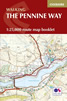 Map of the 270 miles (435km) Pennine Way National Trail, between Edale in the Peak District and Kirk Yetholm in the Scottish Borders. This booklet is included with the Cicerone guidebook to the trail, and shows the full route on Ordnance Survey 1:25,000 maps. This popular long-distance route typically takes three weeks to complete.
More information
Dark Peak Walks
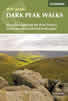 Guidebook to 40 walks in the Dark Peak area of the Peak District National Park. 35 circular routes for most abilities, from 8km to 19km, around Edale, Marsden, Fairholmes, Baslow and Castleton, including Kinder Scout and Mam Tor, and 5 longer (25km to 45km) routes highlighting the best of the Gritstone Edges, High Moorland and Deep Valleys.
More information
Messaging & Social Media
Message Walking Britain and follow the latest news.

Mountain Weather
Stay safe on the mountains with detailed weather forecasts - for iOS devices or for Android devices.