Garnshaw House & Linton Falls from Grassington
Yorkshire Dales Walk
Nat Park - Yorkshire Dales - Upper Wharfedale
County/Area - North Yorkshire
Author - Lou Johnson
Length - 3.0 miles / 4.9 km Ascent - 480 feet / 145 metres
Time - 2 hours 0 minutes Grade - easy
Maps 

| Ordnance Survey Explorer OL2 | Sheet Map | 1:25k | BUY |
| Anquet OS Explorer OL2 | Digital Map | 1:25k | BUY |
Walk Route Description

Click image to see photo description.
This short Yorkshire Dales walk from Grassington starts from the National Park Centre (grid ref. SE002637) where there is a large pay and display car park. The route explores typical countryside of the area east of the town and follows a short section of the River Wharfe to visit the Linton Falls.
Exit the car park and turn left along Hebden Road. Cross the road using the zebra crossing and continue towards the centre of the town. Turn right into Main Street and walk up through the main shopping centre to reach the Town Hall. Turn right into Low Lane and take High Lane which is the first left and leads to Hebden. Follow this walled track for about 250 metres and turn left onto a signed path (grid ref. SE006641). The path crosses several fields to reach a path junction in 400 metres (grid ref. SE009640). Bear right here and continue past the ruins of Wise House to reach a junction of paths just before Garnshaw House (grid ref. SE017637).
Turn right and follow the path down to the B6265 (grid ref. SE016631). Cross the road with care and take the signed path across fields to pass Half Way House Farm. Continue on this path down to the banks of the River Wharfe (grid ref. SE007631). Turn upstream, with the River Wharfe on your left, following the Dales Way. Across the river is the attractive Linton Parish Church. Continue along the Dales Way to reach Linton Falls (grid ref. SE 0016330. Reaching Linton Falls turn right up Sedber Lane back to the start.
Other walks nearby
| Walk 1292 | Linton & Thorpe Fell & Cracoe | moderate | 9.0 miles |
| Walk 1407 | Thorpe & Burnsall from Linton | easy/mod | 6.2 miles |
| Walk 2610 | Hebden Gill & Cupola Corner | easy/mod | 6.5 miles |
| Walk 2611 | Hebden Gill from Hebden | easy | 4.0 miles |
| Walk 1280 | Trollers Gill | moderate | 9.0 miles |
| Walk 2000 | Wharfedale Circular | moderate | 13.5 miles |
| Walk 1576 | Embsay Reservoir | easy | 1.0 miles |
| Walk 3301 | Conistone to Grassington via the Dib | easy | 5.0 miles |
| Walk 3262 | Copplestone Gate and Conistone Pie from Conistone | easy/mod | 7.0 miles |
| Walk 2423 | Capplestone Gate & Conistone Pie | easy/mod | 6.8 miles |
Recommended Books & eBooks
Trail and Fell Running in the Yorkshire Dales
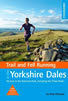 Guidebook to 40 of the best trail and fell runs in the Yorkshire Dales National Park. Ranging from 5 to 24 miles, the graded runs start from bases such as Ribblehead, Dent, Sedbergh, Malham and Grassington and take in the region's diverse delights, from castles and waterfalls to iconic mountains such as Whernside, Ingleborough and Pen Y Ghent.
More information
Walking in the Yorkshire Dales: South and West
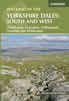 Part of a two-book set, this guidebook describes 44 walks in the southern and western Yorkshire Dales, including the famous 23 mile Three Peaks circuit over Pen-y-Ghent, Whernside and Ingleborough. The other, mostly circular routes of 3½ to 13 miles cover the scenic region between Sedbergh, Kirkby Lonsdale, Settle, Skipton and Grassington.
More information
Messaging & Social Media
Message Walking Britain and follow the latest news.

Mountain Weather
Stay safe on the mountains with detailed weather forecasts - for iOS devices or for Android devices.