West Anstey Common from Molland
Exmoor Walk
Nat Park - Exmoor
County/Area - Devon
Author - Lou Johnson
Length - 6.4 miles / 10.4 km Ascent - 950 feet / 288 metres
Time - 4 hours 10 minutes Grade - easy/mod
Maps 

| Ordnance Survey Explorer OL9 | Sheet Map | 1:25k | BUY |
| Anquet OS Explorer OL9 | Digital Map | 1:25k | BUY |
Walk Route Description
Click image to see photo description.
Starting from Molland this Devon walk explores an area of high Exmoor moorland to the northwest of the village. The route follows paths and bridleways which for the most part are well signed and waymarked. After leaving Molland, with its interesting parish church, the walk climbs steadily onto the moors at Anstey Gate. After passing a memorial to rugby player Philip Hancock, the rote descends to the southern edge of the moors to follow fields paths and a country lane across pleasant countryside back to Molland.
A small parking area by St Mary's Church in Molland (grid ref. SS818284) is a convenient place to start. After parking, face the church and turn left. Continue past the London Inn and take the first lane on the right. Follow the lane as it bends right and continue ahead to a fingerpost which directs you have left across a field. Aim for the gap in the hedge and maintain direction across the next field to a small gate and Moor Lane. Cross the lane and enter the field opposite. The path initially goes half left before dropping into a valley. Cross the footbridge and continue up to Stonemoor Lane (grid ref. SS814290).
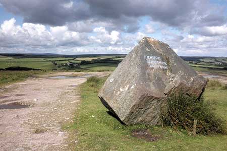
Take the narrow lane opposite and continue past Smallcombe Farm, cross a ford and enter open moorland. Follow the bridleway north-east. After a steady climb over moorland, the path veers east and continues to a road at Anstey Gate (grid ref. SS835298). Bear right across a cattle grid, following the road for 500 metres to reach the Memorial, which lies off the road to your left. Return to the road and continue east for 100 metres to pass a boundary stone also on your left (grid ref. SS840296).
Turn off the road and walk half left on a grassy path that descends south-east to a lane (grid ref. SS844289). Turn right along the lane for just under two kilometres to reach the steep sided valley of Anstey Combe on the right (grid ref. SS827294). Continue ahead for a further 600 metres and turn left onto a bridleway through a gate (grid ref. SS821291). Follow the bridleway south to join a road. Turn right (signed to Molland). Follow the road around a left-hand bend and turn right up steps to join a footpath (grid ref. SS818283). After a short steep ascent, the path continues across three fields (with hedge right) to reach Latchgate Cross. Take the lane opposite to Molland.
Other walks nearby
| Walk 1860 | The River Barle and Withypool from Tarr Steps | easy/mod | 7.5 miles |
| Walk 1669 | Anstey Gate & Hawkridge from Tarr Steps | moderate | 8.2 miles |
| Walk 2451 | Withypool & Barle Valley | easy/mod | 6.0 miles |
| Walk 1222 | Winsford Hill & the Allotment | moderate | 6.0 miles |
| Walk 3386 | Barle Valley & Cow Castle from Simonsbath | easy/mod | 6.4 miles |
| Walk 1750 | Dunkery Beacon (short ascent) | easy/mod | 2.5 miles |
| Walk 1727 | Shallowford, Hoar Oak Tree & The Chains | moderate | 11.7 miles |
| Walk 2387 | Pinkery Pond Circular | easy/mod | 5.8 miles |
| Walk 1220 | Dunkery Beacon | moderate | 8.0 miles |
| Walk 1263 | The Doone Valley | moderate | 8.5 miles |
Recommended Books & eBooks
No suggestions for this area.Messaging & Social Media
Message Walking Britain and follow the latest news.

Mountain Weather
Stay safe on the mountains with detailed weather forecasts - for iOS devices or for Android devices.