Adlestrop & Chastleton
Oxfordshire Walk
County/Area - Oxfordshire
Author - Lou Johnson
Length - 3.8 miles / 6.2 km Ascent - 400 feet / 121 metres
Time - 2 hours 20 minutes Grade - easy
Maps 

| Ordnance Survey Explorer 248 | Sheet Map | 1:25k | BUY |
| Anquet OS Explorer 248 | Digital Map | 1:25k | BUY |
Walk Route Description
Click image to see photo description.
A circular walk from Adlestrop explores the area northwest of the village. The route includes a pleasant walk along the Long Drive through woodland, the Iron Age hillfort of Chastleton Barrow, the village of Chastleton with its glorious parkland and Jacobean Mansion. The route includes a section of the Macmillan Way.
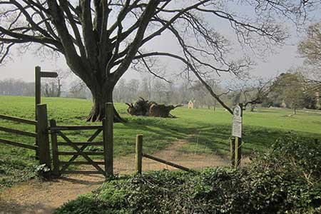
The start is the small car park adjacent to Adlestrop village hall (grid ref. SP272242). After parking exit the parking area and turn left along the road. Follow the road out of the village. Ignore a signed footpath on the right and continue ahead and around a right-hand bend. After 150 metres take the signed path on the left (grid ref. SP248271) and follow the path through woodland along the Long Drive. Exiting the trees, the path bears right to reach a T-junction of paths. Turn left and shortly after take the right fork. The path passes through woodland and then keeps to the edge of the wood (on your left). At the end of the trees maintain direction across a field following a grassy path. Reaching trees on the far side of the field, the path bears left. Take the first junction on the right to reach a road (grid ref. SP256283).
Cross the road and take the track opposite (slightly to the left). After 60 metres take a clear path on the right which leads to Chastleton Barrow, which is surrounded by trees. After exploring the remains of the hill fort, retrace your steps back to the track and continue straight across to join a well-defined path. After 600 metres the path exits at a lane (grid ref. SP253288). Bear right along the lane heading slightly downhill. You have now joined the Macmillan Way. Continue to St Mary's Church which is reached after 600 metres.
Turn left through the wooden gate opposite the church and almost immediately turn right and follow the path to reach a small car park. (If you would like to see Chastleton House, then proceed up the road a few metres before returning to the gate.)Turn left through a gate top follow a wide path through an avenue of trees. At the end of the avenue the onward path crosses fields. The path is clear and is part of the Macmillan Way. As you near Adlestrop the path joins the access dive to Fern Farm, which is followed south to enter the village with the car park on your right.
Other walks nearby
| Walk 2076 | Kingham to Charlbury | easy/mod | 10.5 miles |
| Walk 2687 | Chadlington Circular | easy/mod | 6.3 miles |
| Walk 2283 | Church Westcote & Icomb Circular | easy/mod | 5.1 miles |
| Walk 2484 | Icomb & Wyck Rissington Circular | easy/mod | 5.2 miles |
| Walk 1360 | Naunton & the Slaughters | moderate | 11.0 miles |
| Walk 1439 | Fulbrook & Widford | easy | 6.0 miles |
| Walk 3728 | Ledwell & Nether Worton from Great Tew | easy/mod | 6.4 miles |
| Walk 1848 | Turkdean & Notgrove from Cold Aston | easy/mod | 6.5 miles |
| Walk 2168 | The Slaughters | easy/mod | 8.6 miles |
| Walk 2489 | Upper Brailes Circular | easy/mod | 5.6 miles |
Recommended Books & eBooks
No suggestions for this area.Messaging & Social Media
Message Walking Britain and follow the latest news.

Mountain Weather
Stay safe on the mountains with detailed weather forecasts - for iOS devices or for Android devices.