Chesham & Little Missenden Circular
Chilterns Walk
Region - Chilterns
County/Area - Buckinghamshire
Author - Lou Johnson
Length - 9.4 miles / 15.3 km Ascent - 800 feet / 242 metres
Time - 5 hours 30 minutes Grade - easy/mod
Maps 

| Ordnance Survey Explorer 181 | Sheet Map | 1:25k | BUY |
| Anquet OS Explorer 181 | Digital Map | 1:25k | BUY |
Walk Route Description
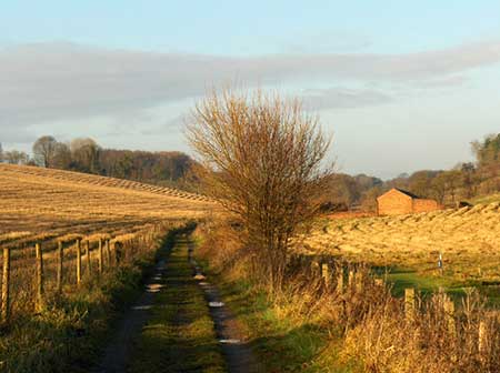
Click image to see photo description.
A circular walk from Chesham exploring pleasant countryside and woodland typical of the Chilterns. The route uses paths and bridleways with a short section along a road. The walk is designed for arrival by tube using the Metropolitan Line to Chesham. Alternatively ample parking is available nearby. The route follows a section of the Chiltern Link through Herberts Hole to reach South Heath. Turning south the walk passes through Little Missenden before returning to Chesham.
The start is the London Underground Station at Chesham (grid ref. SP961016) served by trains from central London. Exit the station, cross the forecourt, and turn left down Station Road and continue to The Broadway. Turn right and bear left by the war memorial. Go straight across a mini-roundabout and continue to a larger roundabout. Use the pedestrian crossing to reach the park opposite. Walk ahead with Scottowe's Pool on your left to teach a wide tarmac path and turn left. Continue for 300 metres to a metal gate and turn right onto Bury Lane. You are now following the Chiltern Link path. The path runs to the left of the drive and continues as a track into a field. The onward path follows the left-hand edge of the field, passes through trees, crosses two stiles, heads across a field and exits onto a lane at a gate (grid ref. SP949019).
Cross the lane and take the gate opposite. The path heads across fields crossing two stiles to reach Drydell Lane. Ignore the first bridleway on the left and continue a short distance to the next signed footpath on the left (signed Herberts Hole). Continue up the dry valley of Herberts Hole to the end of the track. Pass through three gates. After the third gate, with woodland on your left, turn left at a waymark into the trees and continue through the wood to a lane (grid ref. SP923022). Turn left, ignore the first path on the right and continue to the next path on the right opposite a house. Cross the stile and cross fields to reach woodland. The path follows the left-hand edge of the wood and is waymarked. Reaching a T-junction, turn left and continue along the edge of the wood to reach a tarmac drive. Turn right and after 100 metres, turn left on to a signed path initially running between hedges. Maintain direction across two fields to reach a road at Hyde End (grid ref. SP917012).
Turn left and continue to the first signed footpath on the right. Pass to the left the Hyde and where the drive bends right, veer left to join a path between trees. Cross a stile, enter a field and keep to the right-hand edge to another stile. Maintain direction across the next field and head uphill to a stile in the right-hand corner. Go straight across a track and join the path into woodland. The path runs just inside the left-hand-edge of the wood before turning left through a hedge gap into a pasture. Turn right keeping to the right-hand edge of the field. After a short way the path bears left across the filed to continue along the edge of Mantle's Wood. At the end of the wood continue half-left across a field to re-enter woodland heading uphill. Nearing the far side of the wood, turn right downhill at a junction. Cross the footbridge over the railway and maintain direction to reach the A413 (grid ref. SU921992).
Take care crossing this busy road and cross the stile opposite. The path runs along the left-hand edge of a field, crosses a footbridge, and leads to a road by Little Missenden Church, which has long history and is worth visiting. Turn left through the attractive village of Little Missenden and continue to the A413. Cross the main road to the slip road opposite and bear right. Take the first signed footpath on the left. Follow the path as it bends right to recross the railway. Turn left on the other side and walk parallel to the railway. Turn right across the second stile Continue across fields to enter Bray's Wood and continue through trees to a road (grid ref. SU931998). Turn right through Hyde Heath After 600 metres you reach a T-junction with the village hall on the left. Turn right and then left onto a signed footpath (also signed to the Church). The tarmac path soon becomes a rough track. Just before a metal gate (400 metres from the road), turn right and continue into White's Wood. Exit the trees and continue across fields to Halfway House Farm and a road. Turn right for just over a kilometre to Chesham. Reaching the Queen's Head, bear left and follow Church Street and continue to the main road. Turn right, cross the pedestrian crossing, turn left and then first right (continuation of Church Street) to reach the pedestrianised High Street. Turn left and then right into Station Road back to the start.
Other walks nearby
| Walk 1149 | Chesham to Rickmansworth (Chess Valley) | easy/mod | 10.5 miles |
| Walk 1060 | Little Missenden and Amersham | easy/mod | 8.5 miles |
| Walk 1392 | Chesham & Cholesbury Circular | moderate | 16.0 miles |
| Walk 2928 | Amersham to Chorleywood via Chalfont St Giles | easy/mod | 8.5 miles |
| Walk 1517 | Amersham circular via Hyde Heath and Little Missenden | easy/mod | 8.0 miles |
| Walk 1373 | Amersham Old Town Circular | easy/mod | 11.5 miles |
| Walk 1071 | Chalfont & Latimer, Chalfont St Giles & Chorleywood | easy/mod | 12.6 miles |
| Walk 1536 | Sarratt Bottom and Chenies from Little Chalfont | easy/mod | 6.3 miles |
| Walk 1568 | Chalfont and Latimer, Flaunden and Chorleywood | moderate | 11.7 miles |
| Walk 3443 | Chalfont & Latimer, Latimer and Flaunden | moderate | 13.7 miles |
Recommended Books & eBooks
No suggestions for this area.Messaging & Social Media
Message Walking Britain and follow the latest news.

Mountain Weather
Stay safe on the mountains with detailed weather forecasts - for iOS devices or for Android devices.