St Margaret's at Cliffe from Kingsdown
Kent Walk
County/Area - Kent
Author - Lou Johnson
Length - 6.3 miles / 10.2 km Ascent - 850 feet / 258 metres
Time - 4 hours 0 minutes Grade - easy/mod
Maps 

| Ordnance Survey Explorer 138 | Sheet Map | 1:25k | BUY |
| Anquet OS Explorer 138 | Digital Map | 1:25k | BUY |
Walk Route Description

Click image to see photo description.
Starting from Kingsdown this circular walk follows the coastal path south to St Margaret's at Cliffe before returning by an inland path back to the start. The coastal path runs along the top of white chalk cliffs and offers views across the English Channel to the French Coast. The inland stretch of the route crosses farmland with limited views to the sea.
The walk starts from where limited parking is available on Kingsdown seafront along the southern end of Wellington Parade (grid ref. TR380485). After parking join the signed coastal path and head south with sea to your left. After a short section of concrete path, the route runs along the back of the beach before veering right to join a road. Continue south along the road to a right-hand bend. Leave the road and climb the steps on the right to reach the cliff top path. Follow the coastal path for 2.5 kilometres to reach the Dover Patrol Memorial (grid ref. TR374452).
With tour back to the memorial, pass through the wooden kissing gate ahead and bear right to rejoin the coastal path with views ahead to the white cliffs. Keep to the path nearest the sea to reach a series of steps which lead down to the seafront in St Margaret's at Cliffe. Turn right and just before the Coastguard Pub, bear right up Bay Hill. Arriving at the first junction take the signed footpath opposite. Climb the steps and continue up to re-join Bay Hill. Turn right and at the next junction fork left into Hotel Road. After 100 metres turn left up steps onto a signed footpath. Reaching Granville Road go straight across along Cavanagh Road. At the end, join a grass path that leads up to The Droveway (grid ref. TR366448).
Turn right and continue for 500 metres into open countryside. The lane bends left and then right to pass Bockhill Farm on your right. Just past the farm buildings the track bends left ad continues across fields. After 600 metres the path bends left through a kissing gate to join a clear track. Turn sharp right to follow cycleway no.1. The track passes between trees where you turn left through the hedge into a field. Continue along the clear path for about 1400 metres to reach Victoria Road (grid ref. TR373478). Bear right and follow the road to a junction., Turn left along The Avenue and the right down Upper Street. Follow this road keeping ahead at all junctions to reach Cliffe Road. Go straight across down a narrow road (South Road) and continue the short distance back to the start on Kingsdown seafront.
Other walks nearby
| Walk 1895 | Kent Coast Path from Deal | easy/mod | 8.2 miles |
| Walk 1561 | Ramsgate to Margate, Isle of Thanet | easy/mod | 7.8 miles |
| Walk 2923 | Folkestone to Dover along the North Downs Way | easy/mod | 8.2 miles |
| Walk 3219 | Canterbury to Whitstable | easy/mod | 10.5 miles |
| Walk 2249 | Reculver & St Nicholas at Wade | easy/mod | 8.2 miles |
| Walk 3617 | The Wye Downs and Crundale | easy/mod | 6.0 miles |
| Walk 2444 | Wye, Crundale & Wye Downs | moderate | 8.6 miles |
| Walk 2805 | Chilham circular from Wye | moderate | 17.0 miles |
| Walk 1044 | Wye and the Crundale Downs | moderate | 9.2 miles |
| Walk 1637 | Rivers Swale & Oare | easy | 5.0 miles |
Recommended Books & eBooks
Walking in Kent
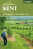 A guidebook describing 40 walks in the county of Kent. Covering west Kent and The Weald and north and east Kent, including the Kent Downs and the Greensand Hills. Walks of 5 to 9 miles explore rivers and coastline, beautiful countryside and historic villages. With outlines of 11 longer walks ranging from 15 to 163 miles.
More information
Messaging & Social Media
Message Walking Britain and follow the latest news.

Mountain Weather
Stay safe on the mountains with detailed weather forecasts - for iOS devices or for Android devices.