Beadnell to Craster
Coastal Walk + Pub Walk + Castle
County/Area - Northumberland County
Author - Lou Johnson
Length - 7.9 miles / 12.8 km Ascent - 300 feet / 91 metres
Time - 4 hours 20 minutes Grade - easy/mod
Maps 

| Ordnance Survey Explorer 332 | Sheet Map | 1:25k | BUY |
| Anquet OS Explorer 332 | Digital Map | 1:25k | BUY |
| Ordnance Survey Explorer 340 | Sheet Map | 1:25k | BUY |
| Anquet OS Explorer 340 | Digital Map | 1:25k | BUY |
Walk Route Description

Click image to see photo description.
This linear walk along the Northumberland coast starts from Beadnell and heads south Craster passing 13th-century Dunstanburgh Castle along the way. The route follows the Northumberland Coast Path (also the England Coast Path) offering easy walking with few navigational problems. Highlights of the walk include the fishermen's cottages at Low Newton-by-the-Sea, beautiful sandy beaches, and the imposing ruins of Dunstanburgh Castle. To the end the walk, why not sample the excellent seafood at Craster?
The walk starts from the main carpark at Craster (grid ref. NU256197). The walk uses a bus transfer from Craster to Beadnell (Route X18). Note that services are limited with no buses on Sundays. Alight from the bus in Beadnell and make your way to the sea front and turn right along Harbour Road. Continue ahead forking left (signed to the 18th century lime kilns). Continue to the back of the beach and turn left to the small harbour and adjacent lime kilns. To continue, descend to the beach for about 600 metres to take a path on your right through the dunes to join the coast path (approx. grid ref. NU231281).
Turn left along the coast path, cross the bridge over Brunton Burn, pass Link House Farm, and continue to Low Newton-by-the-Sea where refreshments are available in season. Continue south past Newton Pool Nature Reserve (on your right) and follow the path which runs parallel to the extensive Embleton Bay Beach. As you make progress Dunstanburgh Castle becomes increasingly dominant in the view ahead perched on black Whinstone cliffs. The coast path keeps to the right of the castle and then continues south behind a rocky foreshore to reach Craster. Do allow time to explore the village and harbour before returning to the car park.
Note The route follows the coast path, which in places trends away from the shoreline. You may wish to leave the main path and walk along the beach especially in Beadnell and Embleton Bays.
Other walks nearby
| Walk 2282 | Bewick Moor | moderate | 9.1 miles |
| Walk 3522 | Bamburgh Castle circular | easy/mod | 7.5 miles |
| Walk 2738 | Budle Bay from Bamburgh | easy | 4.0 miles |
| Walk 1805 | An introduction to the Breamish Valley | easy | 2.0 miles |
| Walk 3242 | Holy Island - Lindisfarne Castle & Emmanuel Head | easy | 4.4 miles |
| Walk 3344 | Holy Island & Lindisfarne Castle Circular | easy | 4.3 miles |
| Walk 2095 | Simonside Hills & Rothbury | moderate | 7.9 miles |
| Walk 1766 | Cushat Law and Bloodybush Edge from Hartside | mod/hard | 12.5 miles |
| Walk 2677 | Circuit of Doddington Moor | easy | 3.8 miles |
| Walk 1202 | The Simonside Hills near Rothbury | easy | 4.5 miles |
Recommended Books & eBooks
Walking in Northumberland
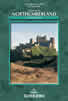 This guidebook contains detailed route descriptions for 36 day walks in Northumberland including the Cheviot Hills. The terrain varies from wild walks and craggy ascents to gentle riverside strolls. Each route ranges from 4 to 16 miles in length and there is the opportunity to link several walks together to create longer treks.
More information
Hadrian's Wall Path
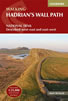 Hadrians Wall Path guidebook to walk the 84 mile National Trail. Described in both directions, the main description is west to east between Bowness-on-Solway and Wallsend, Newcastle, with extensions to Maryport and South Shields. With extensive historical information related to this World Heritage site and separate 1:25,000 OS map booklet included.
More information
Messaging & Social Media
Message Walking Britain and follow the latest news.

Mountain Weather
Stay safe on the mountains with detailed weather forecasts - for iOS devices or for Android devices.