Bunton Hush, Blakethwaite & Gunnerside Gill
Yorkshire Dales Walk
Nat Park - Yorkshire Dales - Swaledale
County/Area - North Yorkshire
Author - Lou Johnson
Length - 5.5 miles / 8.9 km Ascent - 1000 feet / 303 metres
Time - 3 hours 50 minutes Grade - easy/mod
Maps 

| Ordnance Survey Explorer OL30 | Sheet Map | 1:25k | BUY |
| Anquet OS Explorer OL30 | Digital Map | 1:25k | BUY |
Walk Route Description

Click image to visit gallery of 12 images.
Gunnerside was once a busy village and a centre of an extensive lead mining industry with hundreds of miners employed in the mines lying to the north. Today the area is slowly returning to nature with the remains of the mines scattered across the hillsides either side of Gunnerside Gill which runs north from the village into wild upland areas.
The start of this Yorkshire Dales walk is the centre of Gunnerside village where parking is usually available (grid ref. SD950982). The village offers refreshment opportunities. After parking, walk east along the B6270 main road through Swaledale towards Reeth. Immediately after crossing the bridge over Gunnerside Gill, turn left onto a signed footpath beside the river. The way ahead is never in doubt and after a brief detour around a house returns to the river bank. For the first kilometre, the path crosses meadows and passes through pleasant woodland.
Leaving the woodland behind the path passes the remains of an old lead mine (grid ref. SD941995) before climbing over Middle Bank from where there are excellent views of the valley. Evidence of the former mining activity can be seen with spoil from the mine hushes in evidence. Continuing up the valley you reach the adits and buildings of Bunton Hush Mine (grid ref. SD940012) which is an ideal place to take a break and enjoy the surroundings. On the other side of the valley you will see the high track that is used for the return section of the walk.
Just after the buildings at Bunton Hush you reach a four-way fingerpost. Turn left here (signed 'footpath') and descend to the east bank of Gunnerside Gill. Follow the path upstream to reach a stone slab footbridge at Blakethwaite Smelt Mill (grid ref. SD937017). Cross the footbridge and explore the ruins. One option is to continue on the path beside the Gill for 200 metres to see Blakethwaite Force waterfall.
From the smelt mill, cross Blind Gill and follow the green rising track ignoring any minor tracks diverging from the route. The walking is easy and you get fine views of the outward part of the walk. Continue past Botcher Gill Nook and follow the clear track back towards Gunnerside Village. After 2 kilometres of walking the rooftops of Gunnerside village come into view. Descend on the path down to village to end the walk.
Other walks nearby
| Walk 1252 | Great Pinseat | easy/mod | 5.5 miles |
| Walk 1053 | Swinner Gill and Muker | mod/hard | 8.5 miles |
| Walk 1340 | Muker & Upper Swaledale from Keld | easy/mod | 6.5 miles |
| Walk 2190 | Calver Hill & Reeth Low Moor | easy/mod | 6.0 miles |
| Walk 1253 | Booze & Slei Gill from Langthwaite | easy | 2.5 miles |
| Walk 3478 | Cringley Hill & Scar House from Langthwaite | easy/mod | 4.8 miles |
| Walk 1694 | Nappa Hall & Whitfield Gill Force | easy/mod | 6.0 miles |
| Walk 2822 | Aysgarth & Castle Bolton | mod/hard | 14.5 miles |
| Walk 3524 | Semer Water and Cam High Road from Bainbridge | easy/mod | 5.7 miles |
| Walk 1768 | Thomas Gill and Ravenseat from Tan Hill | moderate | 8.7 miles |
Recommended Books & eBooks
Walking in the Yorkshire Dales: South and West
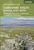 Part of a two-book set, this guidebook describes 44 walks in the southern and western Yorkshire Dales, including the famous 23 mile Three Peaks circuit over Pen-y-Ghent, Whernside and Ingleborough. The other, mostly circular routes of 3½ to 13 miles cover the scenic region between Sedbergh, Kirkby Lonsdale, Settle, Skipton and Grassington.
More information
Walking in the Yorkshire Dales: North and East
 This guidebook contains 43 circular day walks in the north and east Yorkshire Dales. It explores the dales, hills and moors between Kirkby Stephen and Pateley Bridge. Walking ranges from gentle 3 mile strolls to more strenuous day-long rambles across the Howgills, Wensleydale, Swaledale, Nidderdale, Mallerstang and Coverdale.
More information
Messaging & Social Media
Message Walking Britain and follow the latest news.

Mountain Weather
Stay safe on the mountains with detailed weather forecasts - for iOS devices or for Android devices.