Hertford East to Rye House
Hertfordshire Walk
County/Area - Hertfordshire
Author - Peter Smyly
Length - 8.6 miles / 14 km Ascent - 200 feet / 61 metres
Time - 4 hours 30 minutes Grade - easy/mod
Maps 

| Ordnance Survey Explorer 174 | Sheet Map | 1:25k | BUY |
| Anquet OS Explorer 174 | Digital Map | 1:25k | BUY |
Walk Route Description
Click image to visit gallery of 8 images.
This walk explores part of the River Lee Navigation area in rural Hertfordshire, using two railway stations on the same line to start and end the walk. By way of variety, I have added a loop that takes you away from the canal temporarily, pleasant though it is, to offer some different scenery, mainly woods, fields and farm land. The walk includes a stretch of a few miles alongside the River Lea on the approach to Ware, a couple of lakes at the Amwell Nature Reserve and some sweeping lowland landscapes of fields and farm land on the loop beyond Hardmead Lock.
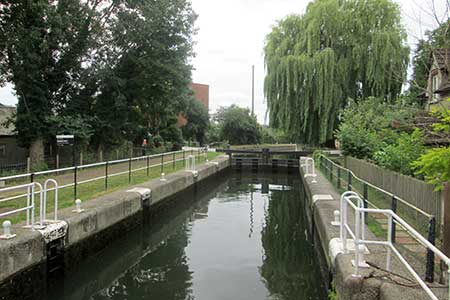
Turn right out of Hertford East station to follow the road as far as Hertford Marina on the left and cross two footbridges to follow a tow path on the right with the canal also on your right due north-east. Follow the path ahead as it meanders across Hartham Common, the confluence of four rivers, the Mimram, Beane, Rib and Lea. The first of the three locks on the walk, Hertford Lock, appears on the right. Cross the bridge with Hertford Lock on your right and continue along the tow path on the other side of the canal, now on your left. The tow path leads to the town of Ware via Ware Lock and on to Hardmead Lock. Beyond this lock is where the 'loop' comes in. Leave the canal at the next footbridge on the left. On the other side of the bridge, a short detour to the right reveals the first, and smaller, of the two lakes on this walk. A noticeboard reveals that this is the home of the 'booming bittern', a member of the heron family. To continue the walk, go back towards the bridge and take a narrow country lane on the right, leading to a track over a footbridge to reveal the second larger lake on the right. When I did this walk in August 2016, a pair of swans added to the serenity of the scene as they gracefully glided across the surface of the water which was gently ruffled by a soft breeze.
Follow the path ahead through woods to emerge into the open and skirt a sloping field with a stream and woods on your left. The ordnance survey map shows a weir on the left and this can be observed by paying careful attention, though it is very small. Next the route ahead passes a road marked 'Private' on the right that leads to The Dairy Farm before passing a wheat field on the left and reaching a junction of paths. A right turn here would shorten the walk but for this route, turn left to cross a footbridge next to a ford by Watersplace Farm, then take the next bridleway on the right, a former railway line. Follow this track as it curves round to the right just before a house and leads uphill to border fields, skirting Doghouse Wood and Young Wood, following the waymarked Hertfordshire Way. The route meanders across fields, passing a pond on the right and goes ahead at a crossroads of bridleways and down to reach a road at Stanstead Abbotts. A left turn here and then a first right leads back to the canal at St Margarets where the railway station of the same name offers a way of concluding the route here. But for this route, cross the bridge over the canal and take the tow path on the left, past the Jolly Fisherman pub, and the tow path leads all the way to the next station further south, Rye House, where there is another pub of the same name as the station.
Other walks nearby
| Walk 3578 | Hertford and Ware Circular | easy | 5.5 miles |
| Walk 1698 | Ware to Enfield Lock - Lea Valley - | easy/mod | 12.5 miles |
| Walk 3352 | The Greenwich Meridian, near Ware | easy | 3.3 miles |
| Walk 1402 | Burnham Green, Tewin and the Mimram Valley | easy | 6.0 miles |
| Walk 1725 | St Margaret's circular via Widford | moderate | 10.2 miles |
| Walk 2348 | Bourne Valley & Sacombe from Wadesmill | easy/mod | 5.8 miles |
| Walk 3661 | Essendon & Little Berkhamsted Circular | easy/mod | 7.4 miles |
| Walk 1741 | Rye House circular via Roydon and Stanstead Abbots | easy/mod | 9.1 miles |
| Walk 1024 | Essendon to Bayford Circular | easy/mod | 10.0 miles |
| Walk 1723 | Broxbourne Circular via Roydon | moderate | 10.3 miles |
Recommended Books & eBooks
No suggestions for this area.Messaging & Social Media
Message Walking Britain and follow the latest news.

Mountain Weather
Stay safe on the mountains with detailed weather forecasts - for iOS devices or for Android devices.