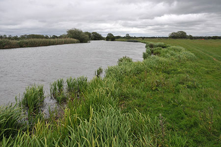
Swinford Bridge from Lower Wolvercote
Oxfordshire Walk
County/Area - Oxfordshire
Author - Lou Johnson
Length - 7.0 miles / 11.4 km Ascent - 200 feet / 61 metres
Time - 3 hours 40 minutes Grade - easy/mod
Maps 

| Ordnance Survey Explorer 180 | Sheet Map | 1:25k | BUY |
| Anquet OS Explorer 180 | Digital Map | 1:25k | BUY |
Walk Route Description
Click image to see photo description.
This Oxfordshire walk explores a section of the River Thames to the west of Oxford. The start is the Port Meadow, Godstow car park (grid ref. SP487094) which can be reached from the A40/A44 roundabout about 3 miles north of the city centre. The route is easy to follow and undemanding.
After parking, exit the car park, cross the road, and turn left along Godstow Road using the pavement. Almost immediately, cross the bridge over a branch of the River Thames (care needed). Continue along the pavement, pass the Trout Inn on your right. Continue across another bridge over the mainstream of the Thames. Immediately turn right down steps to gain the Thames Path beside the river (which will be on your right). Follow the Thames path for six kilometres to reach Eynsham Lock and Swinford Bridge (grid ref. SP443086).
Retrace your steps along the Thames Path and continue to reach Wytham Great Wood after 800 metres. Continue for a further 400 metres to bear right away from the river onto the path waymarked with yellow arrows with the wood on your immediate right. You are now following the Oxford Greenbelt Way. Continue to the end of the wood and turn right onto a track (grid ref. TP462096). The path bears left and then right to regain the edge of the wood.
Turn left onto a track, and after a few metres turn right through a gap. Cross two fields with field boundary on your right. Turn left and follow the clear path alongside the hedge on your left. The path meets a lane. Go straight ahead and continue along a clear track to Wytham Mill where you continue straight ahead across a bridge. Bear half right and follow the path which leads back to the Thames Path. Turn right under the A34 and continue with the river on your left to Godstow Bridge. Climb the steps up to the road and turn left back to the start.
Other walks nearby
| Walk 2322 | Bladon & Begbroke Circular | easy | 5.0 miles |
| Walk 3357 | Blenheim Palace Great Park | easy | 6.6 miles |
| Walk 1062 | Pusey & Buckland circular | easy | 3.5 miles |
| Walk 2687 | Chadlington Circular | easy/mod | 6.3 miles |
| Walk 2628 | Charndon & Edgcott | easy | 6.0 miles |
| Walk 1873 | The Ridgeway from Ardington | easy/mod | 7.0 miles |
| Walk 3728 | Ledwell & Nether Worton from Great Tew | easy/mod | 6.4 miles |
| Walk 1439 | Fulbrook & Widford | easy | 6.0 miles |
| Walk 1061 | Faringdon, Radcot and Littleworth | easy/mod | 8.0 miles |
| Walk 1063 | Faringdon, Buckland & Pusey | easy/mod | 10.5 miles |
Recommended Books & eBooks
The Thames Path Map Booklet
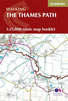 Map of the 180 mile (288km) Thames Path National Trail, from London's Thames Barrier to the river's source near Cirencester in Gloucestershire. This booklet is included with the Cicerone guidebook to the trail, and shows the full route on OS 1:25,000 maps. The easy riverside route takes around two weeks to walk.
More information
Messaging & Social Media
Message Walking Britain and follow the latest news.

Mountain Weather
Stay safe on the mountains with detailed weather forecasts - for iOS devices or for Android devices.