Uldale Falls & Wandale from Rawthey Bridge
Howgills Walk
Nat Park - Yorkshire Dales - Howgill Fells
Region - Howgills
County/Area - Cumbria
Author - Lou Johnson
Length - 8.5 miles / 13.8 km Ascent - 1200 feet / 364 metres
Time - 5 hours 30 minutes Grade - moderate
Maps 

| Ordnance Survey Explorer OL19 | Sheet Map | 1:25k | BUY |
| Anquet OS Explorer OL19 | Digital Map | 1:25k | BUY |
Walk Route Description
Click image to see photo description.
Starting from Rawthey Bridge this walk first explores the wild valley of Uldale with its waterfalls on the River Rawthey. The route crosses the river and returns downstream to enter Wandale and the isolated hamlets of Adamthwaite and Narthwaite which lie at the foot of the Howgill fells. The final section of the walk follows the Rawthey upstream back to the start.
The walk starts from the small car park on the north side of the A683 (grid ref. SD712979) just over a kilometre north from Cross Keys. After parking walk towards the bridge and turn right through a gate onto a grassy track. The track, once the old road from Sedbergh, soon bends right and meanders uphill. After 800 metres and just before a stream, turn left onto the bridleway heading east into Uldale. You soon pass a line of shakeholes crossing onto limestone.
Continue past a lime kiln from where the path is closer to the River Rawthey. Reaching a track branching left to a footbridge, drop down to view the first waterfall. This is one of five on the section upstream from this point. Do not cross the river but continue upstream along a path that is rough in places. Continue past two more falls to Rawthey Gill Quarry. Continue through to end of the quarry to Whin Stone Gill with a small waterfall on this side steam of the river. Before crossing the river, continue upstream for 150 metres to see two further waterfalls. Cross the river to the far side. If the river is in spate return to the bridge passed earlier.
Once across the river, turn left and join a track that leads to Blea Gill Bridge (grid ref. SD732965). Continue past Uldale House along a narrow lane. Ahead is a wonderful view of the Howgill Fells. Continue along the lane for 1.5 kilometres to a T-junction (grid ref. SD723985). Turn left and immediately right onto a signed footpath. Follow the path between walls and drop steeply down to a footbridge over Sally Beck and the A683.Turn left and after 50 metres, turn right onto a signed path, which heads steeply uphill to gate and a track just north of Murthwaite.
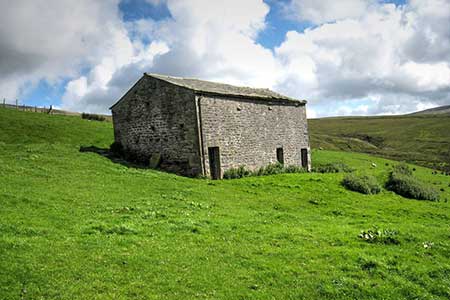
Turn right along the track which soon runs beside a wall on your right. Still beside the wall, fork left and continue along a grassy track heading up Wandale. The track soon reaches a wall on the left. Turn left along the wall and after a few metres turn right onto a footpath (grid ref. SD715993). The path crosses pastures until you are opposite Adamthwaite Farm. The onward path curves left across a bridge to reach the access track for the farm. Turn left through the farmyard and continue south on a distinct track. The way ahead soon crosses the eastern flank of Wandale Hill and maintains direction to reach Narthwaite. The views on this section include Uldale, and Whernside.
Other walks nearby
| Walk 3006 | Cautley Spout & The Calf | moderate | 5.5 miles |
| Walk 1393 | Yarlside | moderate | 4.0 miles |
| Walk 1387 | Cautley Spout | easy | 2.0 miles |
| Walk 1389 | Fell End Clouds | easy | 3.0 miles |
| Walk 1342 | Randygill Top from Weasdale | moderate | 6.0 miles |
| Walk 1160 | Wild Boar Fell & Swarth Fell | moderate | 7.0 miles |
| Walk 1384 | Mallerstang Edge | moderate | 8.8 miles |
| Walk 1616 | Bowderdale and the Calf | moderate | 10.0 miles |
| Walk 2438 | Cautley Spout & the Calf from Sedbergh | moderate | 10.0 miles |
| Walk 3008 | Winder & Arant Haw from Sedbergh | moderate | 7.0 miles |
Recommended Books & eBooks
Walking the Lake District Fells - Langdale
 Part of the Walking the Lake District Fells series, this guidebook covers a wide range of routes to 25 Lakeland summits that can be climbed from the Great Langdale valley, Ambleside and Grasmere, with highlights including Scafell Pike, Bowfell, the Langdale Pikes and Helm Crag (the Lion and the Lamb). Includes suggestions for longer ridge routes.
More information
The Lune Valley and Howgills - A Walking Guide
 A guidebook to 40 walks, from 3 to 11 miles, exploring the Lune Valley and Howgill Fells, some of the most unspoilt countryside in northwest England. Set between the Lake District and the Yorkshire Dales and two other AONBs, the walking is hugely rewarding, near the centres of Sedbergh, Kirkby Lonsdale, Kendal and Lancaster.
More information
Messaging & Social Media
Message Walking Britain and follow the latest news.

Mountain Weather
Stay safe on the mountains with detailed weather forecasts - for iOS devices or for Android devices.