Books and Maps
This section is designed to include a summary of recently published books and mapping useful for all walkers in the British Isles. Links are provided so you can obtain further detailed information and complete on-line purchases.
Cicerone Press 
An excellent range of guides and maps produced by a publisher dedicated to outdoor activities including walking, scrambling and cycling. The following are a selection from their exhaustive catalogue.
Walking Loch Lomond and the Trossachs
 A guide to walking and scrambling routes in the beautiful Loch Lomond and the Trossachs National Park. Over 70 graded low-level, mid-level and mountain walks taking in hills, glens and picturesque woodland, as well as all of the region's Munro summits. Highlights include Ben Lui, Ben Lomond, the Cobbler and the Arrochar Alps.
More information
The Cambrian Way
 Guidebook to the Cambrian Way, a challenging three-week mountain trek through Wales from Cardiff to Conwy. The 470km un-waymarked route is presented from south to north. Often sticking to long, beautiful ridgelines, it crosses wild and rugged terrain and visits many of Wales's highest mountains, including Snowdon.
More information
Pennine Way Map Booklet
 Map of the 270 miles (435km) Pennine Way National Trail, between Edale in the Peak District and Kirk Yetholm in the Scottish Borders. This booklet is included with the Cicerone guidebook to the trail, and shows the full route on Ordnance Survey 1:25,000 maps. This popular long-distance route typically takes three weeks to complete.
More information
Walking the Lake District Fells - Mardale and the Far East
 Part of the Walking the Lake District Fells series, this guidebook covers a wide range of routes to 36 Lakeland summits that can be climbed from the Ullswater, Haweswater, Troutbeck, Kentmere and Longsleddale valleys, with highlights including High Street, Place Fell and the Kentmere fells. Suggestions for longer ridge routes are also included.
More information
Walking the Lake District Fells - Langdale
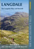 Part of the Walking the Lake District Fells series, this guidebook covers a wide range of routes to 25 Lakeland summits that can be climbed from the Great Langdale valley, Ambleside and Grasmere, with highlights including Scafell Pike, Bowfell, the Langdale Pikes and Helm Crag (the Lion and the Lamb). Includes suggestions for longer ridge routes.
More information
The Borders Abbeys Way
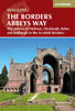 Guidebook to the Borders Abbeys Way, a 68 mile circuit in the Scottish Borders, taking in 4 of Britain's grandest ruined medieval abbeys. Beginning and ending in Tweedbank, the route, which is described over 6 stages, is as rich in history as it is in pastoral charm. Relatively flat, it is suitable for people with a moderate level of fitness.
More information
The Pennine Way
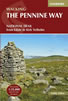 Guidebook to the Pennine Way National Trail with OS map booklet. The 265 mile route from Edale to Kirk Yetholm takes three weeks to walk and is suitable for fit and experienced long distance walkers. The route crosses the Peak District, Yorkshire Dales and North Pennines National Parks. Includes separate OS 1:25,000 map booklet of the route.
More information
Anquet Digital Mapping 
The excellent digital mapping supplied by Anquet is available in a range of formats. Probably the most popular with walkers are their digital format and detailed OS Explorer maps at 1:25k scale. OS Landranger 1:50k maps are also available although showing less detail. Harveys produce Superwalker maps at 1:25k and British Mountain Maps at 1:40k both offering a different style of mapping to the more familiar OS maps. Harvey maps often include additional detail, including more paths, not shown on OS mapping.
For regular walkers there are a number of packages available which offer considerable savings:
| OS Explorer 1:25k Mapping of Complete Great Britain | More Information |
| OS Explorer 1:25k Mapping of British National Parks | More Information |
News & Reviews
A range of product reviews including books and maps are available. The following reviews are the most recent.
Wainwright Hill Bagging Map - A scratchable map showing all 214 Wainwrights in the Lake District. More info.
the people's poncho 2.0 - Lightweight, stylish and lightweight alternative to traditional waterproofs ideal for walkers. More info.
the people's poncho - A durable, lightweight, stylish and compact alternative to traditional waterproofs ideal for walkers with 10% Discount. More info.
AZ Adventure Series Maps - Convenient 1:25000 OS maps in booklet form covering the National Trails of Britain. More info.
Walking in the Aire - A new book by Lee Senior featuring 14 walks in the Aire valley. More info.
West Yorkshire's Wild Side - Two new books in the 'Wainwright' style featuring Calderdale and moorland walks. More info.
Follow Walking Britain for the latest news. 
![]()