Limpsfield Circular
Surrey Walk
County/Area - Surrey
Author - Lou Johnson
Length - 6.0 miles / 9.8 km Ascent - 650 feet / 197 metres
Time - 3 hours 40 minutes Grade - easy/mod
Maps 

| Ordnance Survey Explorer 147 | Sheet Map | 1:25k | BUY |
| Anquet OS Explorer 147 | Digital Map | 1:25k | BUY |
Walk Route Description
Click image to see photo description.
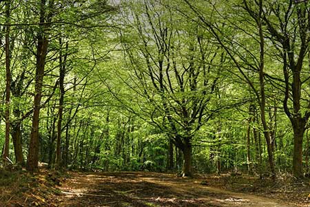
A varied walk exploring the woodland, heath and countryside lying southeast of Limpsfield. The route follows sections of Greensand Way, Vanguard Way, and the Tandridge Border Path. The relevant OS 1:25k Explorer map is useful for sections of the walk.
The walk starts from the Ridlands Grove car park on Ridlands Lane (grid ref. TQ419522). After parking exit the car park and turn left along Ridlands Lane. Continue for 150 metres and take the first signed bridleway on the right. Follow the path across a field and then with hedge on your right to join a driveway. Follow this to a road (grid ref. TQ421518) and turn left to join the Greensand Way. A fingerpost directs the way as the path veers away from the road. Continue straight across lane and continue to the Carpenters Arms. Continue along the front of the Inn and continue to a T-junction. Go straight across and continue along the Greensand Way. 200 metres from the road, the path forks right. Continue for a kilometre along the waymarked path to reach a five-way junction of paths (grid ref. TQ436522) which lies on the Surry/Kent border.
Turn sharp right and follow a section of the Tandridge Border Path (TBP) to a road. Cross the road and take the signed path opposite which descends through woodland. Reaching a drive, turn right to fork left (signed TBP). At the next fork, keep left and continue to descend. Reaching a track (with adjacent finger post) keep right and continue along the TBP to reach a lane (grid ref. TQ430514). Turn left and follow the lane past Trevereux Stables (on your left). 150 metres beyond the stables, where the lane bends left, turn right over a stile. The path follows a hedge on your right. Continue to the top of the field and follow the path as it swings left to cross a stile on your right. Continue with hedge left across the next field and cross a stile and immediately turn right to follow an enclosed path to a stile and a lane (grid ref. TQ425506).
Turn right past The Moat Farm and continue along the lane for 300 metres and turn right over a stile. The path follows the left-hand side of the field to reach a stile in the corner. Continue across a small footbridge and bear right across grass to join a track with a house on your right. Take the first singed path on the left which passes through a garden although an alternative path is available. Continue into a large field and keep to the left-hand edge along a clear path. At the top of the field cross a stile and pass through woodland to reach a track (grid ref. TQ 416517).
Turn left, re-joining the Greensand Way, and shortly after turn right along a tarmac road (Pastens Road). Continue along the road ignoring the path on the right (Greensand Way) and continue to a road. Cross the road and take the narrow lane opposite as directed by the fingerpost. The path passes a house and continues along the edge of woodland to reach a stile and a road (grid ref. TQ406519). Turn right and just before the road bends right, take the signed footpath on the left. A sharp climb through trees and continue up to the main road. Turn right then left at the next junction and shortly after bear right into New Road. Bear right off New Road and follow the path across Limpsfield Common. The Greensand Way soon comes in from the left and this is followed uphill. Reaching a tarmac track, veer left to cross Brick Kiln Lane and join a signed bridleway. |The route follows the edge of a golf course to exit onto Chapel Road (grid ref. TQ416521). Turn left to the B269. Cross the road, turn right and then turn left into Ridlands Lane. The car park used at the start is 200 metres along the road on the left.
Other walks nearby
| Walk 2011 | Chartwell from Crockham Hill | easy | 2.8 miles |
| Walk 3441 | Sevenoaks, Seal Chart and Ightham Mote | moderate | 11.0 miles |
| Walk 2427 | Hever & Markbeech from Chiddingstone | easy | 5.9 miles |
| Walk 3598 | Knockholt via Pratt's Bottom, Mace Farm and The Washneys | easy/mod | 7.3 miles |
| Walk 1510 | Otford, Romney Street & Woodlands | moderate | 14.5 miles |
| Walk 1610 | Otford, Romney Street & Kemsing | mod/hard | 16.8 miles |
| Walk 2683 | Farthing Downs and Happy Valley from Coulsdon South | easy/mod | 6.0 miles |
| Walk 2156 | Lullingstone Castle Circular | easy | 4.0 miles |
| Walk 2333 | Lullingstone & Preston Hill near Shoreham (Kent) | easy/mod | 6.6 miles |
| Walk 1447 | Tadworth Circular | easy/mod | 8.5 miles |
Recommended Books & eBooks
No suggestions for this area.Messaging & Social Media
Message Walking Britain and follow the latest news.

Mountain Weather
Stay safe on the mountains with detailed weather forecasts - for iOS devices or for Android devices.