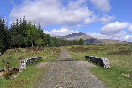
Old Military Road from Victoria Bridge
Moorland Walk + Old Military Road
County/Area - Argyll and Bute
Author - Lou Johnson
Length - 6.5 miles / 10.6 km Ascent - 650 feet / 197 metres
Time - 3 hours 50 minutes Grade - easy/mod
Maps 

| Ordnance Survey Explorer 377 | Sheet Map | 1:25k | BUY |
| Anquet OS Explorer 377 | Digital Map | 1:25k | BUY |
Walk Route Description
Click image to see photo description.
This walk explores a section of General Caulfield's military road which was constructed in the summers of 1751 and 1752. The route starts from Victoria Bridge north of Bridge of Orchy and follows the Old Military Road across wild moorland before returning along the West Highland Way. The walk is easily graded although the outward section is indistinct in places and can be wet underfoot. The use of the relevant OS 1:25k map or digital mapping is a benefit.
To reach the start take the road signed to Forest Lodge across the bridge on the west side of the A82 at Bridge of Orchy. Follow the lane (part of the West Highland Way) past Loch Tulla and the Inveroran Hotel to reach the car park above on the left before Victoria Bridge (grid ref. NN271419). After parking, exit the northern end of the car park to the left of the information boards and descend to the lane and cross Victoria Bridge
Turn left on the track just before Forest Lodge. Continue for 200 metres and turn right to follow a path beside trees on your right. Turn right again after 200 metres and continue for another 200 metres and turn left onto the Old Military Road. The path heads north for 600 metres and then trends right, crosses a burn, and then heads NNE to cross Easan Dubh (grid ref. NN276441). Once across the burn the path trends half right before arcing left to head north to run decide a plantation on your right. On the left are the slopes of Munro Stob a' Coire Odhair.
Continue to the far end of the plantation (grid ref. NN280462) and turn right to reach the West Highland Way. Turn right and follow this popular long-distance trail for five kilometres of easy walking. Reaching Forest Lodge, turn left along the lane and return to the car park.
Other walks nearby
| Walk 1495 | WHW - Day 5 - Inveroran to Kinlochleven | moderate | 19.0 miles |
| Walk 1019 | Beinn an Dothaidh & Beinn Dorain | moderate | 8.5 miles |
| Walk 3277 | Beinn Dorain | mod/hard | 6.2 miles |
| Walk 3273 | Ben Starav | hard | 8.0 miles |
| Walk 1879 | Ben Starav & Glas Bheinn Mhor` | hard | 10.0 miles |
| Walk 3010 | Stob Dearg (Buachaille Etive Mor) from Altnafeadh | mod/hard | 4.0 miles |
| Walk 3269 | The Munros of Buachaille Etive Mor | mod/hard | 8.2 miles |
| Walk 2819 | Stob na Broige, Buchaille Etive Mor, Glen Coe | mod/hard | 6.1 miles |
| Walk 2808 | Buachaille Etive Beag, Glen Coe | hard | 9.0 miles |
| Walk 2554 | The Lost Valley, Glen Coe | easy/mod | 4.2 miles |
Recommended Books & eBooks
West Highland Way Map Booklet
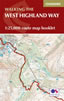 This compact booklet of maps shows the full route of the 95 mile West Highland Way Scottish Long Distance Route, via Loch Lomond and Rannoch Moor. This booklet is included with the Cicerone guidebook to the trail, and shows the full route on Ordnance Survey 1:25,000 maps.
More information
The West Highland Way
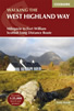 Guidebook to walking the West Highland Way National Trail, a 95 mile Scottish long-distance route from Milngavie near Glasgow to Fort William, passing Loch Lomond and crossing Rannoch Moor. Suggested itineraries over 6 to 9 days. Includes accommodation guide and pull-out 1:25K OS map booklet.
More information
Messaging & Social Media
Message Walking Britain and follow the latest news.

Mountain Weather
Stay safe on the mountains with detailed weather forecasts - for iOS devices or for Android devices.