River Dove & Reynard's Lane from Hartington
Peak District Walk
Nat Park - Peak District - Dovedale Manifold Valley
County/Area - Derbyshire
Author - Lou Johnson
Length - 5.6 miles / 9.1 km Ascent - 800 feet / 242 metres
Time - 3 hours 40 minutes Grade - easy/mod
Maps 

| Ordnance Survey Explorer OL24 | Sheet Map | 1:25k | BUY |
| Anquet OS Explorer OL24 | Digital Map | 1:25k | BUY |
| Ordnance Survey Landranger 119 | Sheet Map | 1:50k | BUY |
| Anquet OS Landranger 119 | Digital Map | 1:50k | BUY |
Walk Route Description
Click image to visit gallery of 3 images.
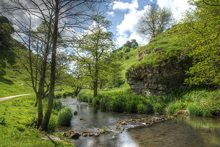
The pretty Derbyshire village of Hartington on the B5054 is an excellent centre for walking particularly along the Dove Valley. The village, with its village pond complete with ducks, has a variety of shops and refreshment opportunities. This Peak District walk explores three limestone dales before following Reynard's Lane across the upland lying to the east of the River Dove. The walking is easy and route finding straightforward.
The centre of Hartington offers adequate parking, including a pay and display car park, although at busy times of the year space may be at a premium. From the centre of the village walk south along the B5054 towards Warslow. Reaching public toilets on the left, take the signed footpath to the left of the toilets. This leads into a field with a clear path heading south. Cross the walled lane (grid ref. SK128599) and continue across more pastures rising slight past the limestone outcrops on the flanks of Pennilow.
The path then descends and enters pleasant woodland to reach the east bank of the River Dove. The path crosses the river on a bridge and continues south with the River Dove now on your left. You are now in Beresford Dale. Reaching Beresford Lane (grid ref. SK128586), cross the Dove using the narrow footbridge or the stepping stones that run parallel on the right. Once across the river continue across a large meadow with the river away to your right. The path soon re-joins the river and enters steep sides Wolfscote Dale with its limestone outcrops adding interest to the scenery.
The River Dove is very pretty with small cascades and excellent limestone scenery. Reaching a path junction at grid ref. SK142569, turn left into Biggin Dale. The path follows the floor of this dry valley. In places the going is quite rough underfoot. Continue up Biggin Dale passing a small cave on your right (grid ref. SK142574). Continue ahead on the obvious path following the valley floor. Some way up the dale you pass through a gate to continue walking up dale with a wall to your left.
Biggin Dale opens out about just over a mile from leaving the River Dove. Reaching a footpath sign in the wall on the left (grid ref. SK145587), turn left signed to Hartington. The path soon divides. Take the rising path heading half left. The path rises quite steeply to reach a gate. Go through the gate and continue up between walls along Reynard's Lane. After half a mile, you reach tarmac (grid ref. SK137594). Continue straight ahead along this quiet lane. This section of the walk offers some fine views to the left over the Dove Valley and the surrounding countryside. All that remains is to enjoy the views and continue along Reynard's Lane as it descends into Hartington. Reaching a T-junction, turn left and complete the final descent back into the village. Turn left along the main road and you are soon back in Hartington village centre.
Other walks nearby
| Walk 1369 | Tissington Trail - Hartington to Parsley Hey | easy | 4.0 miles |
| Walk 2455 | Lum Edge & Revidge Moor | easy/mod | 6.5 miles |
| Walk 1021 | Milldale & Hall Dale | easy/mod | 5.0 miles |
| Walk 1257 | Wolfscote Dale | easy/mod | 7.5 miles |
| Walk 1709 | Milldale and Wolfscote Dale | easy/mod | 6.5 miles |
| Walk 3597 | Manifold Valley, Thor's Cave, Ecton & Wetton Hills from Alstonefield | moderate | 10.0 miles |
| Walk 3601 | Dove & Manifold Valleys | moderate | 10.0 miles |
| Walk 3709 | Sparklow, Crowdicote & Pilsbury Circular | easy/mod | 9.0 miles |
| Walk 1181 | Wetton Hill & the Manifold Valley | easy/mod | 6.5 miles |
| Walk 1653 | The Manifold Valley from Wetton | easy/mod | 7.8 miles |
Recommended Books & eBooks
Walking in the Peak District - White Peak East
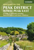 Guidebook describing 42 half-day and day walks in the limestone landscapes of Derbyshire's White Peak, part of the Peak District National Park. One of two volumes, this book covers the east of the region, with potential bases including Bakewell, Eyam, Castleton, Birchover, Matlock and Wirksworth.
More information
Walking in Derbyshire
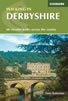 Walking guidebook to 60 circular day walks in Derbyshire and the Peak District. Includes the Derwent, Wye and Trent river valleys, near Derby, Matlock, Glossop, Bakewell and Ripley. Routes range from easy to moderate and are between 4 and 14km (2 to 10 miles). Walks focus on places of interest, from Stone Age forts to castles to grand estates.
More information
Messaging & Social Media
Message Walking Britain and follow the latest news.

Mountain Weather
Stay safe on the mountains with detailed weather forecasts - for iOS devices or for Android devices.