Ayot Green Circular
Hertfordshire Walk
County/Area - Hertfordshire
Author - Barry Mackie
Length - 4.3 miles / 6.9 km Ascent - 250 feet / 76 metres
Time - 2 hours 20 minutes Grade - easy
Maps 

| Ordnance Survey Explorer 182 | Sheet Map | 1:25k | BUY |
| Anquet OS Explorer 182 | Digital Map | 1:25k | BUY |
| Ordnance Survey Landranger 166 | Sheet Map | 1:50k | BUY |
| Anquet OS Landranger 166 | Digital Map | 1:50k | BUY |
Walk Route Description
Click image to visit gallery of 6 images.
This circular walk starts in the picturesque Hertfordshire village of Ayot Green and includes a section following a former railway. The walk continues through typical Herfordshire countryside to reach the banks of the River Lea, which is followed to Brocket Hall. The concluding section passes through woodland.
To reach the start, turn off the B197, which skirts the western side of Welwyn Garden City, to the village of Ayot Green, following the signs to Ayot St Peter. As you leave the village, turn right into the free car park (grid ref TL 221144) approx 50 yards before the T junction.
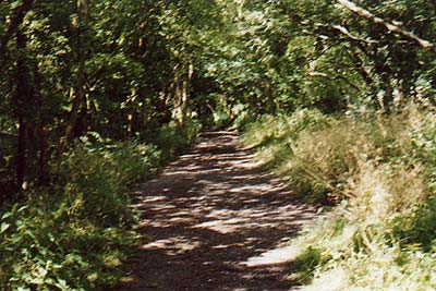
Leave the car park and walk down the road to the junction, cross the road at this point and walk up the steps cut into the bank, and onto the Ayot Green Way. This is the disused railway track that was once the link from Luton to Welwyn Garden City. Turn left heading in a north westerly direction, and follow the path through light woodland and open ground for one and three quarter miles until you reach Robinson's Wood.
Turn left as you reach the edge of the Wood (Grid ref. TL200143) and heading south, follow the track down the gentle slope for nearly a quarter of a mile until you reach the River Lea and the path marked as the Lee Valley Walk. The river is fenced off here and as the banks are left to their natural state, it may be a while before you actually get to see it Turn left and follow the way markers until you reach The Ford. Here you will see the river, which in seasonally wet weather will flood the road. Should this be the case a raised pedestrian footpath is in place for a safe crossing.
Stay on the Lea Valley Walk following the line of the river until you enter the grounds of Brocket Hall. Walk across the golf course staying on the permissive path, go past Brocket Hall (on your right) and at the end of a wooded area turn sharp left in a NNE direction (grid ref TL 216128) following the yellow way markers, still making your way across the golf course.
The walk continues through undulating ground through a wooded area known as Cat's Gallows and on to the boundary of the estate. Leave Brockett Hall opposite the Wagoners PH, turn left, and left again at the road junction, then follow the road down through the village and back to the car park.
Other walks nearby
| Walk 2457 | Stanborough Park, Welwyn Garden City | easy | 2.0 miles |
| Walk 1372 | Ayot St Lawrence Circular | easy | 6.0 miles |
| Walk 2338 | The Upper Mimram Valley | easy | 5.7 miles |
| Walk 2944 | Ayot St Lawrence to Ayot St Peter Circular | easy | 4.6 miles |
| Walk 1532 | Wheathampstead circular | easy | 4.5 miles |
| Walk 2441 | Lea Valley from Mill Green to Ware | easy/mod | 9.5 miles |
| Walk 1402 | Burnham Green, Tewin and the Mimram Valley | easy | 6.0 miles |
| Walk 1022 | Sandridge Circular | easy | 4.0 miles |
| Walk 1607 | Sandridge, Coleman Green & Brocket Hall Circular | easy/mod | 9.0 miles |
| Walk 1024 | Essendon to Bayford Circular | easy/mod | 10.0 miles |
Recommended Books & eBooks
No suggestions for this area.Messaging & Social Media
Message Walking Britain and follow the latest news.

Mountain Weather
Stay safe on the mountains with detailed weather forecasts - for iOS devices or for Android devices.