Buckinghamshire WalksWalking Routes & Hiking Trails
Find Buckinghamshire walks from the list below which features the best walking routes in the area. Most of routes are circular walks although there are a few linear hikes. The walks are listed from the shortest and easiest to the longest more challenging routes. The walks are divided into sub areas so you can find specific walks.
The Buckinghamshire walks below are free to download and print, and all routes have GPS files. The highlights of this attractive county include the Chiltern Hills, the Chess Valley, attractive villages, fine country houses set in parkland and circular walks in Wendover Woods to the highest point in the County. Routes also include sections of one of the oldest paths in Britain along the ancient Ridgeway.
North Buckinghamshire & Wendover Walks
This area includes walks in the Vale of Aylesbury, and walking routes from Wendover, a popular starting point for walks in Wendover Woods and to Coombe Hill and Chequers.
| Walk | Description | Grade | Miles |
|---|---|---|---|
| 3345★ | Coombe Hill from Wendover | easy | 4.00 |
| 3361★ | Chackmore Circular | easy | 4.00 |
| 3244★ | Stowe Park from Chackmore | easy | 4.30 |
| 2968★ | Hillesden from Steeple Claydon | easy | 4.50 |
| 2755★ | Great Horwood & Adstock circular | easy | 5.50 |
| 2628★ | Charndon & Edgcott | easy | 6.00 |
| 1604★ | Long Marston circular | easy/mod | 6.50 |
| 2490★ | Quainton & North Marston Circular | easy/mod | 6.80 |
| 2052★ | Wendover Woods | easy/mod | 7.00 |
| 3314★ | Akeley & Maids Moreton | easy/mod | 7.00 |
| 1138★ | The Ridgeway at Chequers | easy/mod | 7.25 |
| 2420★ | The Ridgeway south of Wendover | easy/mod | 7.25 |
| 3358★ | Chequers and Coombe Hill from Wendover | easy/mod | 7.50 |
| 1943★ | Cheddington to Tring via Marsworth | easy/mod | 8.00 |
| 2389★ | Wing & Cublington Circular | easy/mod | 8.00 |
| 2167★ | Thame Valley & the Winchendons | easy/mod | 9.00 |
| 1717★ | Chiltern Hills circular from Wendover | moderate | 10.00 |
| 3669★ | Grand Union Canal - Aylesbury to Wendover | moderate | 11.70 |
South Buckinghamshire & Chess Valley Walks
South Buckinghamshire includes walks near Amersham, Chesham, Princes Risborough and Beaconsfield. Chess Valley walks are also very popular with paths easy to follow and well-signed.
| Walk | Description | Grade | Miles |
|---|---|---|---|
| 2398★ | Turville Circular | easy | 4.10 |
| 3360★ | Cholesbury Camp and Hawridge | easy | 4.40 |
| 1965★ | Piddington & Horsleys Green Circular | easy | 4.90 |
| 1536★ | Sarratt Bottom and Chenies from Little Chalfont | easy/mod | 6.25 |
| 1517★ | Amersham circular via Hyde Heath and Little Missenden | easy/mod | 8.00 |
| 2470★ | West Wycombe & Bledlow Ridge | moderate | 8.20 |
| 2928★ | Amersham to Chorleywood via Chalfont St Giles | easy/mod | 8.50 |
| 3359★ | Christmas Common, Ibstone Common & Turville Heath | easy/mod | 8.50 |
| 1060★ | Little Missenden and Amersham | easy/mod | 8.50 |
| 1333★ | The Ridgeway around Chinnor | easy/mod | 9.00 |
| 2669★ | Beaconsfield Circular | easy/mod | 9.00 |
| 3520★ | Princes Risborough circular | easy/mod | 9.50 |
| 1966★ | Turville & Hambleden circular | moderate | 9.60 |
| 3321★ | Denham Circular | easy/mod | 10.00 |
| 1149★ | Chesham to Rickmansworth (Chess Valley) | easy/mod | 10.50 |
| 1617★ | Saunderton circular via Bledlow Ridge | moderate | 11.25 |
| 1954★ | Fingest & Turville from Hambleden | moderate | 11.40 |
| 1373★ | Amersham Old Town Circular | easy/mod | 11.50 |
| 1568★ | Chalfont and Latimer, Flaunden and Chorleywood | moderate | 11.70 |
| 1071★ | Chalfont & Latimer, Chalfont St Giles & Chorleywood | easy/mod | 12.60 |
| 3443★ | Chalfont & Latimer, Latimer and Flaunden | moderate | 13.70 |
| 1392★ | Chesham & Cholesbury Circular | moderate | 16.00 |
Walks that start in adjacent counties / areas.
Walks that start in adjacent counties or areas but cross the boundary and include sections of the route within Buckinghamshire.
| Walk | Description | Starts In |
|---|---|---|
| 2396★ | Finmere & Westbury | Oxfordshire |
| 3128★ | Henley-on-Thames, Aston and Hambleden | Oxfordshire |
| 2324★ | Christmas Common Circular | Oxfordshire |
| 1720★ | Henley-on-Thames to Marlow along the Thames Path | Oxfordshire |
| 1007★ | The Ashridge Estate circular | Hertfordshire |
| 2064★ | Ivinghoe Beacon from the Ashridge Estate | Hertfordshire |
| 2399★ | The Chilterns above Tring (short version) | Hertfordshire |
| 1999★ | The Chilterns above Tring | Hertfordshire |
| 2071★ | Ivinghoe Beacon and Bridgewater Monument from Tring | Hertfordshire |
| 3098★ | Tring & Wendover Woods | Hertfordshire |
| 3409★ | The Three Counties Tops | Bedfordshire |
| 1909★ | Woburn Circular | Bedfordshire |
| 1816★ | Old Linslade Circular | Bedfordshire |
| 3420★ | Cookham to Gerrards Cross via Burnham Beeches | Berkshire |
★ GPS file ☩ Route profile
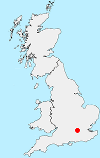
Location Map
Buckinghamshire Guide
The County of Buckinghamshire is noted for its open countryside and natural features, including the Chiltern Hills Area of Outstanding Natural Beauty which occupy the southern part of the County. Walks along the River Thames, through Wendover Woods and along the Ridgeway long-distance footpath are full of interest. With many attractive towns and villages, walking always offers variety. Walks can also be combined with one of the many historic houses in the area. The highest point in Buckinghamshire is Haddington Hill in Wendover Woods at 267 metres above sea level.
Other walks in Britain - For a list of all the areas where walks are available go to the Main Walk Index.
Walk grading - Learn how each walk is assessed and select a walk to suit your ability and experience by going to Walk Grading Details.
Messaging & Social Media
Message Walking Britain and follow the latest news.

Mountain Weather
Stay safe on the mountains with detailed weather forecasts - for iOS devices or for Android devices.