Thame Valley & the Winchendons from Cuddington
Buckinghamshire Walk
County/Area - Buckinghamshire - North Buckinghamshire
Author - Lou Johnson
Length - 9.0 miles / 14.6 km Ascent - 700 feet / 212 metres
Time - 5 hours 10 minutes Grade - easy/mod
Maps 

| Ordnance Survey Explorer 181 | Sheet Map | 1:25k | BUY |
| Anquet OS Explorer 181 | Digital Map | 1:25k | BUY |
Walk Route Description
Click image to see photo description.
This Buckinghamshire walk starts from Cuddington and explores the countryside northeast of the village. The route includes a section of the River Thame valley, the parkland of Eythrope and the villages of Upper and Nether Winchendon. Using mainly well used paths and bridleways, this walk provides a taste of the area to the west of Aylesbury.
The walk starts from Cuddington which lies to the north of the A418. Limited on street parking is normally available near the Green (grid ref. SP738111). After parking walk north along Upper Church Street. When the street bends right by the church, turn left along Tibbys Lane (signed footpath to Lower Winchendon. Entering fields, the path follows the right-hand edge and continues to the Old Mill (grid ref. SP738121). Pass to the left of the house and then turn right keeping a shed on your right to join the Thame Valley Walk.
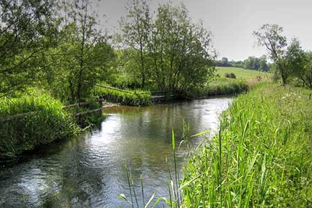
The path crosses afield, a ditch and continues across the next field. Aim for the left-hand side of a small wood. The onward path is well defines and runs roughly parallel with the River Thame on your right. After just over three kilometres of easy walking you reach Bridge Lodge (grid ref. SP767135). Turn left onto the Swan's Way and after 200 metres by Beachendon Cottages turn left and continue to Eythrope Park gate (grid ref. SP770140). Turn left on the Swan's Way heading northwest. Pass a wood on your right and at the end of the wood bear right and continue to North Lodge (grid ref. SP760151).
Turn left through trees and then alongside the wood and after 800 metres from North Lodge turn right onto a woodland path, marked by a wooden post (grid ref. SP754148). If you reach a drive, you have gone too far! Follow the path through the wood and exit onto Waddesdon Hill. Turn right and take the first signed path on the left. Walk through trees to reach a drive. Turn right and continue along the drive for just under a kilometre and turn left through a gate (grid ref. SP745156). The path heads south across fields to reach a tree-lined grass ride (grid ref. SP745150). Bear left along the waymarked path soon cutting half-right aiming for the left a small group of trees. Once past the trees turn left and pass in front of the church (on your left). Reaching a gravel drive in front a cottage, turn right and continue a few metres to take a diagonal path on the right that crosses a field (grid ref. SP7461440), Continue to Main Road in Upper Winchendon.
Cross Main Road and take the track opposite. The track passes a wooden building on the left, bends half right and passes cottage on the left. The onward field path crosses two stiles. After the second stile (grid ref. SP 746139) walk half right. The path continues across fields and is waymarked with yellow arrows crossing several stiles before reaching Old Mill passed earlier in the walk. Turn right along the lane and continue into Nether Winchendon. Reaching the church, turn left and continue to the phone box by Manor Farm. Turn left along the track opposite the phone box (footpath sign behind the phone box) and continue across a bridge over the River Thame and over fields to join a lane which leads back to The Green in Cuddington.
Other walks nearby
| Walk 3669 | Grand Union Canal - Aylesbury to Wendover | moderate | 11.7 miles |
| Walk 2490 | Quainton & North Marston Circular | easy/mod | 6.8 miles |
| Walk 2478 | Great Kimble Circular | moderate | 11.2 miles |
| Walk 3520 | Princes Risborough circular | easy/mod | 9.5 miles |
| Walk 2052 | Wendover Woods | easy/mod | 7.0 miles |
| Walk 2420 | The Ridgeway south of Wendover | easy/mod | 7.3 miles |
| Walk 1717 | Chiltern Hills circular from Wendover | moderate | 10.0 miles |
| Walk 3358 | Chequers and Coombe Hill from Wendover | easy/mod | 7.5 miles |
| Walk 3345 | Coombe Hill from Wendover | easy | 4.0 miles |
| Walk 1140 | The Ridgeway around Lewknor | moderate | 13.0 miles |
Recommended Books & eBooks
No suggestions for this area.Messaging & Social Media
Message Walking Britain and follow the latest news.

Mountain Weather
Stay safe on the mountains with detailed weather forecasts - for iOS devices or for Android devices.