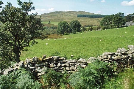
Rhobell Fawr and Ddualt from near Rhydymain
Snowdonia/Eryri Walk
Nat Park - Snowdonia - Arenigs
County/Area - Gwynedd
Author - Lou Johnson
Length - 8.5 miles / 13.8 km Ascent - 2400 feet / 727 metres
Time - 6 hours 40 minutes Grade - moderate
Maps 

| Ordnance Survey Explorer OL23 | Sheet Map | 1:25k | BUY |
| Anquet OS Explorer OL23 | Digital Map | 1:25k | BUY |
| Ordnance Survey Landranger 124 | Sheet Map | 1:50k | BUY |
| Anquet OS Landranger 124 | Digital Map | 1:50k | BUY |
Walk Route Description
Click image to visit gallery of 8 images.
This Snowdonia (Eryri) walk combines two rarely visited summits that lie to the north of the A494 Bala to Dolgellau road near the village of Rhydymain. The summit if Rhobell Fawr is the easier of the two in respect of access whilst Ddualt does need some perseverance especially in penetrating the conifer plantation. However once that challenge has been overcome the summit of Ddualt provides a quiet place to contemplate the view.
Leave the A494 just west of Rhydymain and turn north at a junction (grid ref. SH799216) marked Aran Hall School. Continue up this narrow lane turning right at the second junction (Grid ref. SH796222). Follow this lane, climbing uphill to reach a gate (Grid ref. SH796232)with parking available on the verge.
After parking take the right hand track and follow this as it climbs in a wide loop into the forest. Alternatively take the signed bridleway that short cuts the loop. The track is clear and the gradient easy with progress fast. Reaching a junction of tracks (grid ref. SH796244), turn left and continue along this track to the edge of the forest. Climb the fence and take the easiest route to reach a track.
Turn west along this track and at the first wall (Grid ref SH791247) head north uphill encountering a few short scrambles in a rocky landscape as you climb higher. Views to the Arans to the south and Cadair Idris open up as you gain height. Following the wall you reach a stile where you turn sharp left from where the trig point on Rhobell Fawr soon becomes visible. Climb over the stile to the top where the views are outstanding to the Rhinogs and north to Snowdon.
Descend from Rhobell Fawr in an easterly direction crossing the stile used on the ascent. Rather than descend along the wall used for the ascent head east following a wall down to reach a track (Grid ref. SH798254). Turn left along this track to reach a junction of tracks (Grid ref. SH800264). Turn sharp right here and walk southeast to reach the boundary fence to the plantation (Grid ref. SH804259). At times the going is hard particularly towards the edge of the forest.
Climb the fence and walk easy following the boundary of the plantation. Reaching a corner, turn north initially following the fence but eventually taking a more direct route to the summit of Ddualt, which is now in view. Goods views of the Arans, Arenigs and Rhobell Fawr can be enjoyed in peace from this rarely visited summit.
To return retrace you steps to the edge of the forest and the track junction at grid ref. SH800264. Turn sharp left here and return to the start following the track all the way down. Sadly the final section through the conifers is depressing but you can reflect on a pleasant and quiet excursion into the hills of this quiet part of Wales.
Other walks nearby
| Walk 2551 | Rhobell Fawr from near Rhydymain | moderate | 5.7 miles |
| Walk 2937 | Aran Fawddwy northern approach | mod/hard | 8.4 miles |
| Walk 1646 | The Precipice Walk | easy | 3.5 miles |
| Walk 1107 | Waun Oer and Maesglase near Dinas Mawddwy | mod/hard | 11.0 miles |
| Walk 2334 | The Torrent Walk near Dolgellau | easy | 1.6 miles |
| Walk 1190 | Aran Fawddwy | mod/hard | 7.5 miles |
| Walk 3055 | Glasgwm | moderate | 4.5 miles |
| Walk 1255 | The Aran Ridge | hard | 11.2 miles |
| Walk 1400 | The Arans | hard | 14.0 miles |
| Walk 2059 | Castell Carndochan near Bala | easy/mod | 2.5 miles |
Recommended Books & eBooks
The Cambrian Way
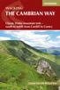 Guidebook to the Cambrian Way, a challenging three-week mountain trek through Wales from Cardiff to Conwy. The 470km un-waymarked route is presented from south to north. Often sticking to long, beautiful ridgelines, it crosses wild and rugged terrain and visits many of Wales's highest mountains, including Snowdon.
More information
The Wales Coast Path
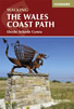 A single guidebook to walking the whole Wales Coast Path - 1400km (870 miles) the length of Wales from Chester to Chepstow, including Anglesey, described in 57 stages. The route passes through the Snowdonia and Pembrokeshire National Parks and many AONBs and can be linked with the Offa's Dyke Path for a complete circuit of Wales.
More information
Messaging & Social Media
Message Walking Britain and follow the latest news.

Mountain Weather
Stay safe on the mountains with detailed weather forecasts - for iOS devices or for Android devices.