The Cheviot from Langleeford
Northumberland Walk
Nat Park - Northumberland
County/Area - Northumberland County
Author - Lou Johnson
Length - 8.2 miles / 13.3 km Ascent - 2000 feet / 606 metres
Time - 6 hours 10 minutes Grade - mod/hard
Maps 

| Ordnance Survey Explorer OL16 | Sheet Map | 1:25k | BUY |
| Anquet OS Explorer OL16 | Digital Map | 1:25k | BUY |
Walk Route Description
Click image to see photo description.
This walk to The Cheviot's summit starts in the Harthope Burn valley near Langleeford. The route follows the Harthope Burn climbing gently to reach Scotsman's Knowe. The route turns north to join the Pennine Way at Cairn Hill for the final ascent to the summit. The descent heads northeast to Scald Hill from where the route returns to the valley.
The start is the small roadside parking area (grid ref. NT953225) on the south side of the minor road from Wooler about 600 metres before Langleeford. After parking, follow the road to Langleeford and take the track through a gate. Continue along the clear track up the valley to reach some farm buildings at Langleeford Hope (grid ref. NT933208). The track soon ends so follow the footpath on the north side of Harthope Burn. The path fades in places but the way ahead is obvious with a steady climb up the valley. Reaching the head of the valley a short steeper section leads up to a fence at Scotsman's Knowe (grid ref. NT905190).
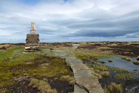
Turn right and keeping the fence on your left head uphill to a stile on Cairn Hill. Turn right onto the Pennine Way, which is paved for some of this section. Height is gained quickly, and you soon reach the summit of The Cheviot with its OS trig column perched on a high base. Despite being the highest point in the Northumberland National Park there is little to commend the view.
Continue ahead for 2.5 kilometres descending with the fence to your right to reach Scald Hill. This gradual descent does offer improving views which extend to the coast on fine days. From Scald Hill continue beside the fence for 500 metres. Just before the fence bends left, leave the fence (grid ref. NT933221), and descend on a good path into the valley. Reaching the road, turn left and the start is a short walk away.
Other walks nearby
| Walk 1766 | Cushat Law and Bloodybush Edge from Hartside | mod/hard | 12.5 miles |
| Walk 2299 | The Cheviot | moderate | 9.0 miles |
| Walk 1314 | Great Hetha and Elsdon Burn from Hethpool | easy/mod | 4.0 miles |
| Walk 3644 | Blackhaggs Rigg & Great Hetha from Hethpool | moderate | 9.6 miles |
| Walk 3646 | Hethpool, Sutherland Bridge & Great Hetha | moderate | 6.0 miles |
| Walk 3739 | Elsdonburn & Trowupburn from Hethpool | moderate | 8.2 miles |
| Walk 1805 | An introduction to the Breamish Valley | easy | 2.0 miles |
| Walk 2677 | Circuit of Doddington Moor | easy | 3.8 miles |
| Walk 1201 | Black Hag from Kirk Yetholm | moderate | 8.5 miles |
| Walk 1200 | Windy Gyle | moderate | 7.5 miles |
Recommended Books & eBooks
Hadrian's Wall Path
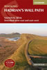 Hadrians Wall Path guidebook to walk the 84 mile National Trail. Described in both directions, the main description is west to east between Bowness-on-Solway and Wallsend, Newcastle, with extensions to Maryport and South Shields. With extensive historical information related to this World Heritage site and separate 1:25,000 OS map booklet included.
More information
Walking in Northumberland
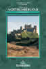 This guidebook contains detailed route descriptions for 36 day walks in Northumberland including the Cheviot Hills. The terrain varies from wild walks and craggy ascents to gentle riverside strolls. Each route ranges from 4 to 16 miles in length and there is the opportunity to link several walks together to create longer treks.
More information
Messaging & Social Media
Message Walking Britain and follow the latest news.

Mountain Weather
Stay safe on the mountains with detailed weather forecasts - for iOS devices or for Android devices.