Lathkill Dale & Over Haddon circular
Peak District Walk
Nat Park - Peak District - Lathkill Dale High Peak
County/Area - Derbyshire
Author - Lou Johnson
Length - 5.7 miles / 9.3 km Ascent - 900 feet / 273 metres
Time - 3 hours 50 minutes Grade - easy/mod
Maps 

| Ordnance Survey Explorer OL24 | Sheet Map | 1:25k | BUY |
| Anquet OS Explorer OL24 | Digital Map | 1:25k | BUY |
Walk Route Description
Click image to see photo description.
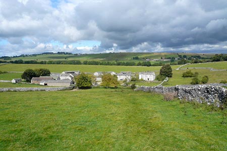
This Peak District walk explores one of the many Derbyshire Dales. The walk starts from the village of Over Haddon and descends into Lathkill Dale with a two-mile section along this scenically interesting valley with its woodland and limestone crags. The route then turns south up steep-sided Cales Dale before using a section of the Limestone Way to cross upland pastures. The walk then heads to Meadow Place Grange from where a descend back into Lathkill Dale is followed by a short climb back to the start.
There is a pay and display carpark in Over Haddon (grid ref. SK2036640 which makes a convenient place to start the walk. After parking, exit the car park and turn right and follow the lane downhill into the valley and Lathkill Dale. Turn right up the dale following a clear and well-trodden path initially through woodland before the dale opens up to reveal limestone crags on either side of the valley. After two miles of easy walking you reach a footbridge (grid ref. SK174655).
Cross the footbridge and walk into narrow Cales Dales again edged with limestone outcrops. After a short ascent turn left onto the Limestone Way. The path climbs steeply out of the Dale to reach open farmland. Continue on the clear path passing to the left of Calling Low Farm to reach Back Lane (grid ref. SK192644).
Turn left along the lane for just over 600 metres and take the waymarked path on the left which leads across fields to Meadow Place Grange (grid ref. SK200658). Follow the signed path through the buildings and across a field to reach the rim of Lathkill Dale. Descend into the Dale, cross the footbridge and take the lane you used at the start of the walk uphill and back to the carpark.
Other walks nearby
| Walk 1569 | Lathkill Dale & Bradford Dale | easy/mod | 8.2 miles |
| Walk 1589 | Lathkill & Bradford Dales (short version) | easy/mod | 6.0 miles |
| Walk 1590 | Monyash & Lathkill Dale | easy/mod | 8.2 miles |
| Walk 2798 | Bakewell to Edale | mod/hard | 18.0 miles |
| Walk 3018 | Cracknowl and the Monsal Trail | easy | 3.5 miles |
| Walk 1827 | Ashford-in-the Water,Magpie Mine & Over Haddon | easy/mod | 7.1 miles |
| Walk 2503 | Robin Hood's Stride & Stanton Moor | moderate | 11.0 miles |
| Walk 1651 | Monsal Trail & Ashford-in-the-Water from Lees Bottom | easy/mod | 8.8 miles |
| Walk 3341 | Brushfield, Miller's Dale & Monsal Head from Lees Bottom | easy/mod | 6.5 miles |
| Walk 1146 | Bradford & Lathkill Dales | moderate | 11.3 miles |
Recommended Books & eBooks
Dark Peak Walks
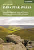 Guidebook to 40 walks in the Dark Peak area of the Peak District National Park. 35 circular routes for most abilities, from 8km to 19km, around Edale, Marsden, Fairholmes, Baslow and Castleton, including Kinder Scout and Mam Tor, and 5 longer (25km to 45km) routes highlighting the best of the Gritstone Edges, High Moorland and Deep Valleys.
More information
Walking in the Peak District - White Peak East
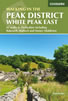 Guidebook describing 42 half-day and day walks in the limestone landscapes of Derbyshire's White Peak, part of the Peak District National Park. One of two volumes, this book covers the east of the region, with potential bases including Bakewell, Eyam, Castleton, Birchover, Matlock and Wirksworth.
More information
Messaging & Social Media
Message Walking Britain and follow the latest news.

Mountain Weather
Stay safe on the mountains with detailed weather forecasts - for iOS devices or for Android devices.